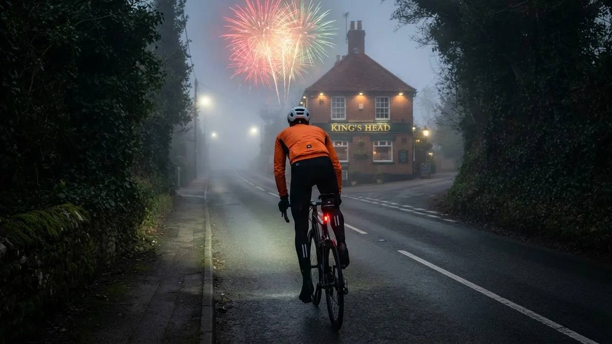
Saturday’s loop out to Charing and Sutton Valence started late in the afternoon, with the light already going, the fog waiting further on and my winter socks on. I headed east through Chart Sutton and Ulcombe to Lenham, and by the time I turned up Hubbards Hill the headlight was doing most of the work.
Hubbards Hill is the way up the North Downs from Lenham, a Cat 4 by Garmin’s reckoning, and it put me on top at Warren Street. From there I followed Otterden Road north towards Newnham, dropped down Kettle Hill and turned back south at Throwley, climbing Faversham Road before the long descent off the Downs.
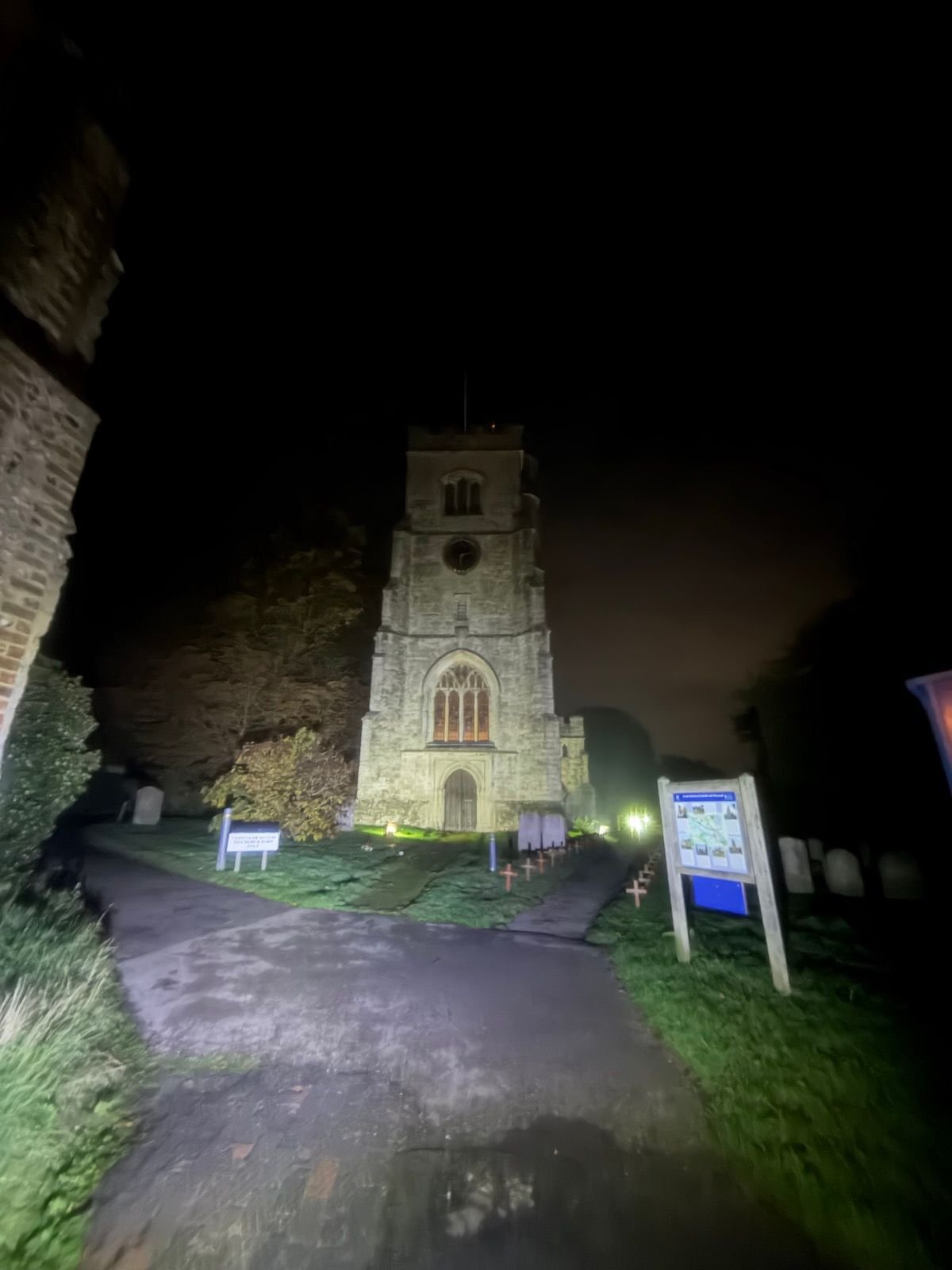
In Charing I stopped at the church. St Peter and St Paul stood floodlit at the end of the churchyard path, its tower pale against the night sky, with rows of small wooden Remembrance crosses along the grass and the old wall of the Archbishop’s Palace on my left. Remembrance Sunday was the next day.
Out of Charing I turned west through Charing Heath, Stonebridge Green and Platt’s Heath, quiet lanes under the Greensand Ridge, then on past Boughton Malherbe. It was Saturday evening rather than midnight, and it showed: 79 vehicles passed me, against just four on the midnight run to Bethersden.
The climb that mattered came near the end: Headcorn Road, the A274, rising at a steady 7% from the Weald into Sutton Valence between high banks of ivy, with the King’s Head and its gold-on-green sign at the top. All evening, sporadic fireworks had been going off through the fog, as they do at this time of year.
From the village I dropped over Chart Hill and wound through the lanes past Linton to the last climb, Hunton Hill, Garmin’s second Cat 4 of the night. Most of Kent stayed hidden in the fog, but the floodlit church at Charing and the lit pub at the top of Sutton Valence were worth coming out for.
The numbers
- Ride: #1140 on Strava, ride 269 of 2026, day 149 of the streak
- Distance: 74.0 km
- Moving time: 3:21:52 (3:26:50 elapsed)
- Elevation: 864 m
- Average power: 124 W
- Heart rate: 116 bpm average, 159 max
- Cadence: 90 rpm average
- Calories: 1,778 kcal
- Highlight (Strava segment): Hubbards Hill, Lenham – 1.42 km, 74 m, 6:03 at 217 W
- Conditions: dusk into dark, fog, 8.9°C, 88% humidity, almost still air from the north
- Year to date: Distance 21,647 km, Elevation Gain 220,078 m
The route
● Favourite Garmin segment ● Shorter segment inside a longer one The numbers match the Segments table below. Hover over a segment for its time and rank; click or tap for a link to it on Garmin Connect.
Download the GPX (start and finish trimmed for privacy)
7 favourite Garmin segments. Best placed: Stonebridge Green Coach Rd, 2.19 km at 1.1%, 8th of my 13 goes (from km 45). Time and power are from this ride; My rank places this ride among all my own goes at that segment. The numbers match the map, and each segment name links to Garmin Connect, where you can save it (you’ll need a Garmin account).
Segments table
| # | Segment | Starts at km | Length | Ascent | Avg grade | Time | Avg speed | Avg power | My rank | My best |
|---|---|---|---|---|---|---|---|---|---|---|
| 1 | Cock to Sutton Valence | 4.9 | 3.50 km | 19 m | 0.4% | 8:32 | 24.6 km/h | 214 W | 53 of 64 | 6:32 |
| 2 | Sutton Valence to Turn | 8.8 | 6.78 km | 33 m | -0.2% | 16:39 | 24.4 km/h | 227 W | 31 of 37 | 12:38 |
| 3 | Hubbards Hill | 19.8 | 1.24 km | 64 m | 4.9% | 5:32 | 13.5 km/h | 208 W | 24 of 28 | 4:14 |
| 4 | Haywards Hill | 29.0 | 0.27 km | 23 m | 8.8% | 1:27 | 11.1 km/h | 241 W | 4 of 4 | 1:20 |
| 5 | Stonebridge Green Coach Rd | 45.1 | 2.19 km | 45 m | 1.1% | 6:41 | 19.6 km/h | 249 W | 8 of 13 | 4:45 |
| 6 | SV to Kings Head | 59.5 | 0.62 km | 47 m | 7.0% | 3:09 | 11.9 km/h | 263 W | 3 of 3 | 2:13 |
| 7 | Hunton Hill | 72.4 | 0.77 km | 70 m | 8.8% | 4:42 | 9.8 km/h | 243 W | 23 of 27 | 3:25 |
The profile and climbs
9 climbs: 2 Cat 4, 7 uncategorised. Biggest: 1.8 km at 5.5%, 99 m of climbing (Cat 4, from km 71). Together the climbs account for 440 m of the ride’s ascent. Garmin and Strava measure climbs and segments over their own start and finish points, so the figures here can differ from the Highlight above and from each other.
Cat 4 Uncategorised Pins mark where each Garmin ClimbPro climb starts. Hover or tap a pin for details.
Climbs table
| # | Climb | Category | Starts at km | Length | Ascent | Avg grade | Time | Avg speed | Avg power | My rank | My best |
|---|---|---|---|---|---|---|---|---|---|---|---|
| 1 | Hubbards Hill, Lenham | Cat 4 | 19.0 | 2.03 km | 85 m | 4.2% | 8:03 | 15.1 km/h | 208 W | 24 of 28 | 6:13 |
| 2 | Haywards Hill | Uncategorised | 28.6 | 0.55 km | 39 m | 7.0% | 2:21 | 14.1 km/h | 281 W | 21 of 38 | 2:06 |
| 3 | Faversham Road, Throwley | Uncategorised | 33.5 | 1.49 km | 52 m | 3.5% | 4:47 | 18.6 km/h | 225 W | 21 of 26 | 4:04 |
| 4 | Faversham Road, Charing | Uncategorised | 36.9 | 0.88 km | 32 m | 3.6% | 2:58 | 17.7 km/h | 194 W | 20 of 26 | 2:17 |
| 5 | Stonebridge Green | Uncategorised | 44.7 | 1.35 km | 44 m | 3.3% | 4:31 | 17.9 km/h | 198 W | 19 of 24 | 3:55 |
| 6 | Boughton Malherbe | Uncategorised | 47.0 | 0.84 km | 22 m | 2.7% | 2:48 | 18.1 km/h | 198 W | 121 of 152 | 1:55 |
| 7 | Headcorn Road, Sutton Valence | Uncategorised | 59.1 | 1.09 km | 63 m | 5.8% | 4:49 | 13.6 km/h | 222 W | 24 of 26 | 3:26 |
| 8 | Hunton Hill | Cat 4 | 71.3 | 1.80 km | 99 m | 5.5% | 8:32 | 12.7 km/h | 196 W | 24 of 25 | 6:30 |
| 9 | Hunton Hill, top | Uncategorised | 73.1 | 0.04 km | 4 m | 11.4% | 0:16 | 9.0 km/h | 217 W | 27 of 91 | 0:11 |
My rank places this ride among my outdoor rides over the same climb on Garmin up to that day, matched by GPS, and My best is the fastest of them at the time. Time and speed include any stop on the climb.
Related
Related rides
- Playing on the Sea Wall: over Charing Hill the other way, heading for the coast
- Egerton by Headlight: another night loop below the Greensand Ridge
Every town, café, beach and landmark from my rides is collected on the Links page.