It was soft and still out there – 10°C, cloudy, 94% humidity and barely a breath of wind from the west-south-west – the kind of damp air that hangs in your headlight like fog. The plan was Zone 2, out to Egerton, home along the ridge.
It starts the easy way, dropping off the hill from home down to Hunton and out onto the flat Weald lanes. From there it was Marden Road and on through Staplehurst, spinning a steady 90-plus cadence with the heart rate sitting in the low 110s and nothing but the beam ahead of me.
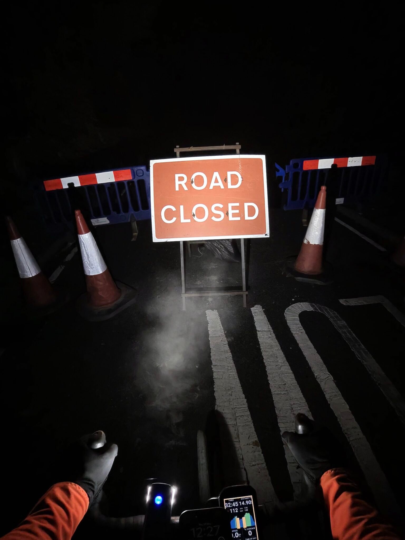
Then, just under 15 km in, between Staplehurst and Headcorn, the headlight found a wall of orange: barriers, cones and a big Road Closed sign. I stopped for a minute, bypassed the road works and was rolling again before the legs had time to cool.
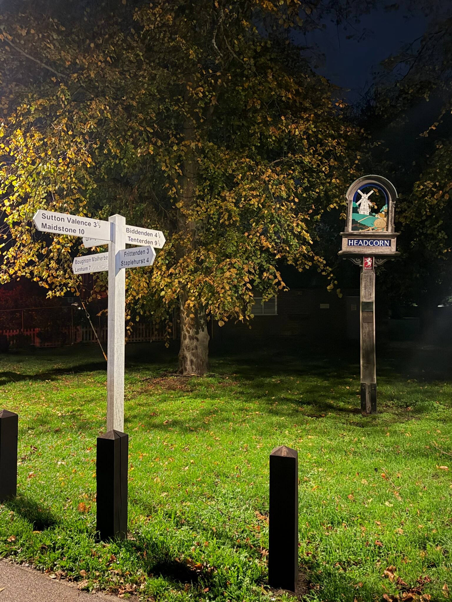
Ten minutes later I pulled up on the green at Headcorn, where the village sign and the old fingerpost were lit up under a tree still holding on to its autumn leaves. Maidstone 10, Tenterden 9, Biddenden 4. A couple of minutes standing in the quiet, then out east past Swift’s Green and Smarden, the road rising so gently you barely notice it.
The real work came at Egerton, the far corner of the loop. Rock Hill Road climbs 82 metres in just over a kilometre and I took it at 206 W in 4:31, with the steep section at 234 W and the heart rate touching 149 – the top of the night. Nothing heroic, but enough to remind the legs what a hill is.
From the top it’s the reward: the Greensand Ridge home, west through Ulcombe, East Sutton and Chart Sutton, along the A274 and back past the Cock Inn to Linton. Long, gently undulating, and the lanes all to myself. The next night I’d be back through Headcorn and Smarden in thick fog, on Warm Mist on Wierton Hill. Road works and all, a good night out.
The numbers
- Ride: #1130 on Strava, ride 259 of 2026, day 139 of the streak
- Distance: 51.6 km
- Moving time: 2:09:28 (2:13:46 elapsed)
- Elevation: 359 m
- Average power: 132 W
- Heart rate: 114 bpm average, 149 max
- Cadence: 91 rpm average
- Calories: 1,202 kcal
- Highlight (Strava segment): Rock Hill Road, Egerton – 1.06 km, 82 m, 4:31 at 206 W
- Conditions: dark, cloudy, 10°C, 94% humidity, barely a breath of WSW wind
- Year to date: Distance 21,173 km, Elevation Gain 216,297 m
The route
● Favourite Garmin segment ● Shorter segment inside a longer one The numbers match the Segments table below. Hover over a segment for its time and rank; click or tap for a link to it on Garmin Connect.
Download the GPX (start and finish trimmed for privacy)
13 favourite Garmin segments. Best placed: Lenham Rd, 3.25 km at 0.2%, 6th of my 13 goes (from km 35). Time and power are from this ride; My rank places this ride among all my own goes at that segment. The numbers match the map, and each segment name links to Garmin Connect, where you can save it (you’ll need a Garmin account).
Segments table
| # | Segment | Starts at km | Length | Ascent | Avg grade | Time | Avg speed | Avg power | My rank | My best |
|---|---|---|---|---|---|---|---|---|---|---|
| 1 | Hunton Hill Down | 0.9 | 0.79 km | 0 m | -8.0% | 0:58 | 49.6 km/h | 151 W | 19 of 38 | 0:47 |
| 2 | Chainhurst Hill | 3.9 | 0.51 km | 9 m | 1.6% | 1:20 | 23.1 km/h | 212 W | 19 of 40 | 0:52 |
| 3 | Pattenden Lane Sprint | 7.3 | 0.50 km | 0 m | 0.4% | 1:08 | 26.4 km/h | 177 W | 122 of 140 | 0:39 |
| 4 | Marden to Staplehurst | 10.4 | 2.15 km | 12 m | 0.1% | 5:02 | 25.6 km/h | 196 W | 11 of 13 | 3:40 |
| 5 | Staplehurst to Headcorn | 13.3 | 6.28 km | 33 m | -0.1% | 15:31 | 24.3 km/h | 202 W | 11 of 15 | 11:30 |
| 6 | Smarden Rd to Bedlam Ln | 20.8 | 1.98 km | 9 m | 0.1% | 4:44 | 25.1 km/h | 198 W | 17 of 25 | 3:13 |
| 7 | Rock Hill | 28.4 | 0.70 km | 43 m | 6.0% | 3:17 | 12.8 km/h | 222 W | 102 of 126 | 2:19 |
| 8 | Stonebridge Green Coach Rd | 30.0 | 2.19 km | 45 m | 1.1% | 6:39 | 19.7 km/h | 232 W | 7 of 12 | 4:45 |
| 9 | Park Rd | 33.6 | 1.06 km | 12 m | 0.4% | 3:01 | 21.0 km/h | 279 W | 7 of 11 | 2:03 |
| 10 | Lenham Rd | 35.1 | 3.25 km | 32 m | 0.2% | 7:58 | 24.4 km/h | 212 W | 6 of 13 | 6:21 |
| 11 | Ulcombe to Sutton Valence | 37.6 | 4.06 km | 9 m | -0.5% | 9:03 | 26.9 km/h | 197 W | 78 of 134 | 6:57 |
| 12 | Sutton Valence to Boughton Monchelsea | 41.6 | 3.85 km | 5 m | -0.5% | 8:28 | 27.3 km/h | 211 W | 93 of 173 | 6:45 |
| 13 | Cock to lights | 45.5 | 1.86 km | 10 m | 0.6% | 5:11 | 21.5 km/h | 192 W | 191 of 215 | 3:06 |
The profile and climbs
3 climbs, all uncategorised. Biggest: 0.9 km at 5.9%, 53 m of climbing (from km 28). Together the climbs account for 113 m of the ride’s ascent. Garmin and Strava measure climbs and segments over their own start and finish points, so the figures here can differ from the Highlight above and from each other. Climbs are the ones Garmin’s ClimbPro found on earlier rides of this route, matched by GPS; length, ascent, time and power are from this ride.
UncategorisedPins mark where each Garmin ClimbPro climb starts. Hover or tap a pin for details.
Climbs table
| # | Climb | Category | Starts at km | Length | Ascent | Avg grade | Time | Avg speed | Avg power | My rank | My best |
|---|---|---|---|---|---|---|---|---|---|---|---|
| 1 | Rock Hill Road | Uncategorised | 28.2 | 0.87 km | 53 m | 5.9% | 3:51 | 13.6 km/h | 223 W | 92 of 126 | 2:42 |
| 2 | Coach Road | Uncategorised | 30.0 | 0.84 km | 38 m | 3.8% | 3:07 | 16.1 km/h | 212 W | 92 of 151 | 2:19 |
| 3 | near Boughton Malherbe | Uncategorised | 32.0 | 0.76 km | 22 m | 2.5% | 2:14 | 20.5 km/h | 222 W | 63 of 151 | 1:43 |
My rank places this ride among my outdoor rides over the same climb on Garmin up to that day, matched by GPS, and My best is the fastest of them at the time. Time and speed include any stop on the climb.
Related
Related rides
- A Mild Night on Babylon Lane: Headcorn again, on an easy loop about two weeks earlier
- Colder and Darker to Rye: onto the Greensand Ridge by Workhouse Lane
Every town, café, beach and landmark from my rides is collected on the Links page.