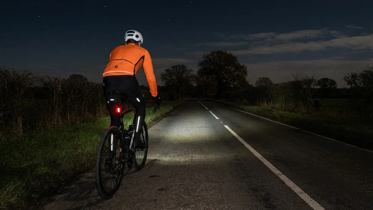
The last time I took a night ride to Bethersden in Kent, a stiff wind and a flat tyre had me walking the top of Hunton Hill. A month on I went back for much the same long loop across the Weald, on a very different night: colder at 6°C, partly cloudy, and with hardly any air moving at all.
Hunton Hill came first this time, downhill and easy, then Chainhurst and Green Lane to Collier Street, where I stopped for a couple of minutes. Sheephurst Lane took me on to Marden, and the flat lanes from there to Staplehurst.
From Staplehurst it was on to Headcorn, past The Bell at Smarden and out through the dark to the edge of Bethersden, 40 km in, where I turned for home. There was no wind to turn into. My power drifted down as the night went on, from around 130 W in the early lanes to around 100 W on the way back, and my heart rate came down with it.
Back past Headcorn I took Cradducks Lane, just outside Staplehurst, where last time I had to get off and walk past the night crew and their lorries. This time I rolled through without stopping. Then it was Pattenden Lane and Underlyn Lane, with just four vehicles passing me in the whole 73 km.
That left Hunton Hill, the steep part I never got to the top of on a bike last month. It went in 4:15 at 289 W on Garmin’s segment, eighth of my 26 goes, and with 70 km already in my legs I’ll take that. Bethersden feels a lot nearer when nothing goes wrong.
The numbers
- Ride: #1138 on Strava, ride 267 of 2026, day 147 of the streak
- Distance: 73.3 km
- Moving time: 3:12:49 (3:20:18 elapsed)
- Elevation: 345 m
- Average power: 114 W
- Heart rate: 108 bpm average, 158 max
- Cadence: 92 rpm average
- Calories: 1,580 kcal
- Highlight (Strava segment): Hunton Hill – 0.82 km, 69 m, 4:24 at 261 W
- Conditions: dark and partly cloudy, 6°C (feels like 6°C), 90% humidity, an easterly at 3 km/h
- Year to date: Distance 21,471 km, Elevation Gain 218,420 m
The route
● Favourite Garmin segment ● Shorter segment inside a longer one The numbers match the Segments table below. Hover over a segment for its time and rank; click or tap for a link to it on Garmin Connect.
Download the GPX (start and finish trimmed for privacy)
14 favourite Garmin segments. Best placed: Hunton Hill, 0.77 km at 8.8%, 8th of my 26 goes (from km 72). Time and power are from this ride; My rank places this ride among all my own goes at that segment. The numbers match the map, and each segment name links to Garmin Connect, where you can save it (you’ll need a Garmin account).
Segments table
| # | Segment | Starts at km | Length | Ascent | Avg grade | Time | Avg speed | Avg power | My rank | My best |
|---|---|---|---|---|---|---|---|---|---|---|
| 1 | Hunton Hill Down | 0.9 | 0.79 km | 0 m | -8.0% | 0:55 | 52.3 km/h | – | 14 of 40 | 0:47 |
| 2 | Chainhurst Hill | 3.9 | 0.51 km | 9 m | 1.6% | 1:22 | 22.5 km/h | 203 W | 22 of 42 | 0:52 |
| 3 | Green Lane | 6.7 | 1.90 km | 4 m | -0.0% | 4:28 | 25.6 km/h | 172 W | 17 of 23 | 3:07 |
| 4 | Green Lane Sprint West to Longend Lane | 6.7 | 0.77 km | 2 m | -0.2% | 1:46 | 26.1 km/h | 173 W | 16 of 23 | 1:11 |
| 5 | Collier St School to Sheephurst | 8.7 | 1.51 km | 3 m | -0.1% | 3:42 | 24.5 km/h | 183 W | 27 of 33 | 2:34 |
| 6 | Sheephurst Lane | 10.3 | 3.14 km | 15 m | 0.2% | 7:46 | 24.3 km/h | 189 W | 21 of 32 | 5:26 |
| 7 | Staplehurst to Headcorn | 21.0 | 6.28 km | 33 m | -0.1% | 15:47 | 23.9 km/h | 185 W | 14 of 16 | 11:30 |
| 8 | Smarden/Headcorn Road Sprint | 28.3 | 3.51 km | 15 m | 0.0% | 8:57 | 23.5 km/h | 179 W | 18 of 28 | 5:53 |
| 9 | Smarden Road Sprint | 28.4 | 2.27 km | 11 m | 0.1% | 5:56 | 22.9 km/h | 179 W | 20 of 28 | 3:43 |
| 10 | Smarden Rd to Bedlam Ln | 28.5 | 1.98 km | 9 m | 0.1% | 5:08 | 23.1 km/h | 183 W | 22 of 26 | 3:13 |
| 11 | Staplehurst – Marden | 60.7 | 2.21 km | 4 m | -0.2% | 5:40 | 23.4 km/h | 169 W | 6 of 8 | 4:50 |
| 12 | Pattenden Lane Sprint | 65.1 | 0.67 km | 0 m | -0.5% | 1:39 | 24.5 km/h | 172 W | 26 of 31 | 0:56 |
| 13 | Pattenden Lane | 65.1 | 1.01 km | 0 m | -0.4% | 2:33 | 23.8 km/h | 162 W | 26 of 31 | 1:26 |
| 14 | Hunton Hill | 71.7 | 0.77 km | 70 m | 8.8% | 4:15 | 10.8 km/h | 289 W | 8 of 26 | 3:25 |
The profile and climbs
2 climbs, all uncategorised. Biggest: 0.9 km at 8.1%, 73 m of climbing (from km 72). Together the climbs account for 77 m of the ride’s ascent. Garmin and Strava measure climbs and segments over their own start and finish points, so the figures here can differ from the Highlight above and from each other.
Uncategorised Pins mark where each Garmin ClimbPro climb starts. Hover or tap a pin for details.
Climbs table
| # | Climb | Category | Starts at km | Length | Ascent | Avg grade | Time | Avg speed | Avg power | My rank | My best |
|---|---|---|---|---|---|---|---|---|---|---|---|
| 1 | Hunton Hill | Uncategorised | 71.6 | 0.90 km | 73 m | 8.1% | 4:52 | 11.1 km/h | 255 W | 41 of 87 | 3:50 |
| 2 | Top of Hunton Hill | Uncategorised | 72.5 | 0.04 km | 4 m | 11.5% | 0:13 | 9.9 km/h | 322 W | 19 of 90 | 0:09 |
My rank places this ride among my outdoor rides over the same climb on Garmin up to that day, matched by GPS, and My best is the fastest of them at the time. Time and speed include any stop on the climb.
Related
Related rides
- Down Linton, Up Hunton: the night before, a third of the distance and a quicker go at the hill
- Egerton by Headlight: another long night out east of Headcorn, with a road closure on the way
Further reading
Bethersden, For the Love of the British Isles: “The name ‘marble’ is misleading because it is a limestone”. A motorcyclist’s tour of the village whose edge I turned round at.
Every town, café, beach and landmark from my rides is collected on the Links page.