
This was the first night test of my Oakley Meta Vanguard glasses with clear lenses. Tinted lenses are no use after dark, so the clear ones are there to keep the wind and grit out of my eyes without leaving me riding blind.
It was a good night to need them. It was 11°C, but a stiff north-north-westerly took that down to a feels-like of under 5°C. At least it was behind me to start with, down Hunton Hill to Yalding, through Collier Street and along Sheephurst Lane, then on across the Weald to Staplehurst, keeping everything easy.
From Staplehurst it was out to Headcorn and past The Bell at Smarden, then on through the dark lanes as far as the edge of Bethersden, where I turned and started working my way back.
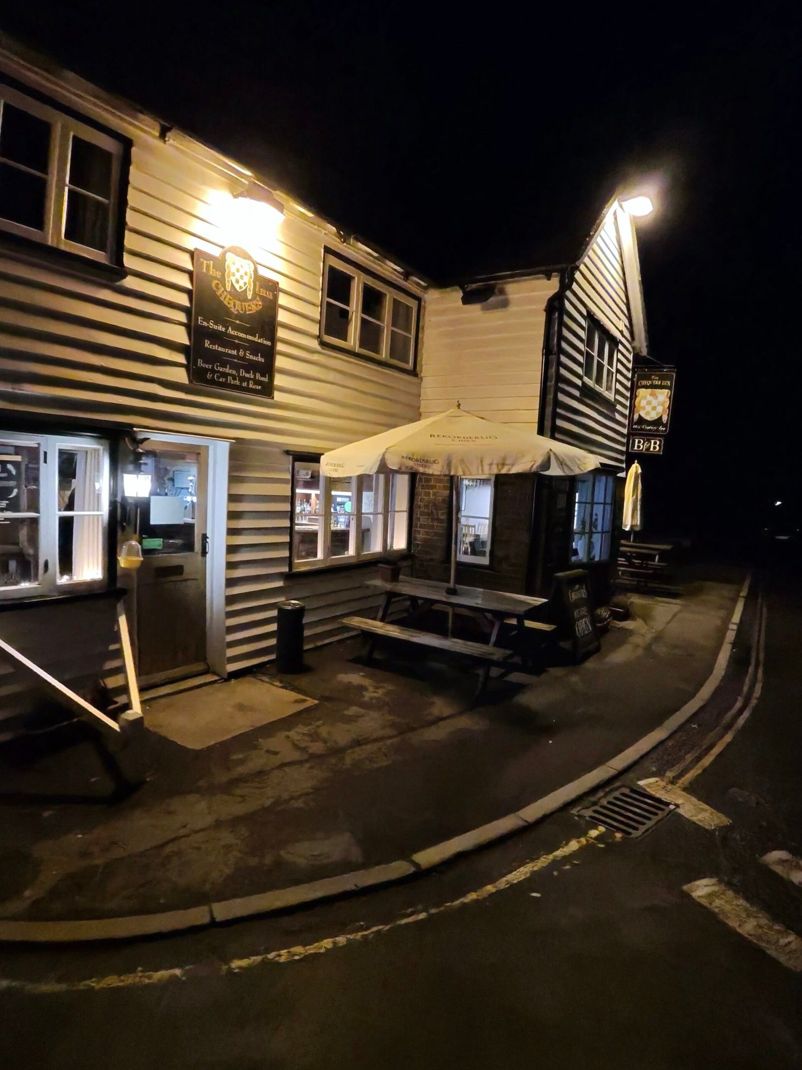
On the way back through Smarden, The Chequers Inn was lit up like a stage set, its weatherboarding glowing under the lamps and the board outside still saying open. I didn’t stop, just took the picture as I rolled through, and it’s the only one I have from the ride.
Heading home meant heading into that wind, and I went a couple of km/h slower for rather less power.
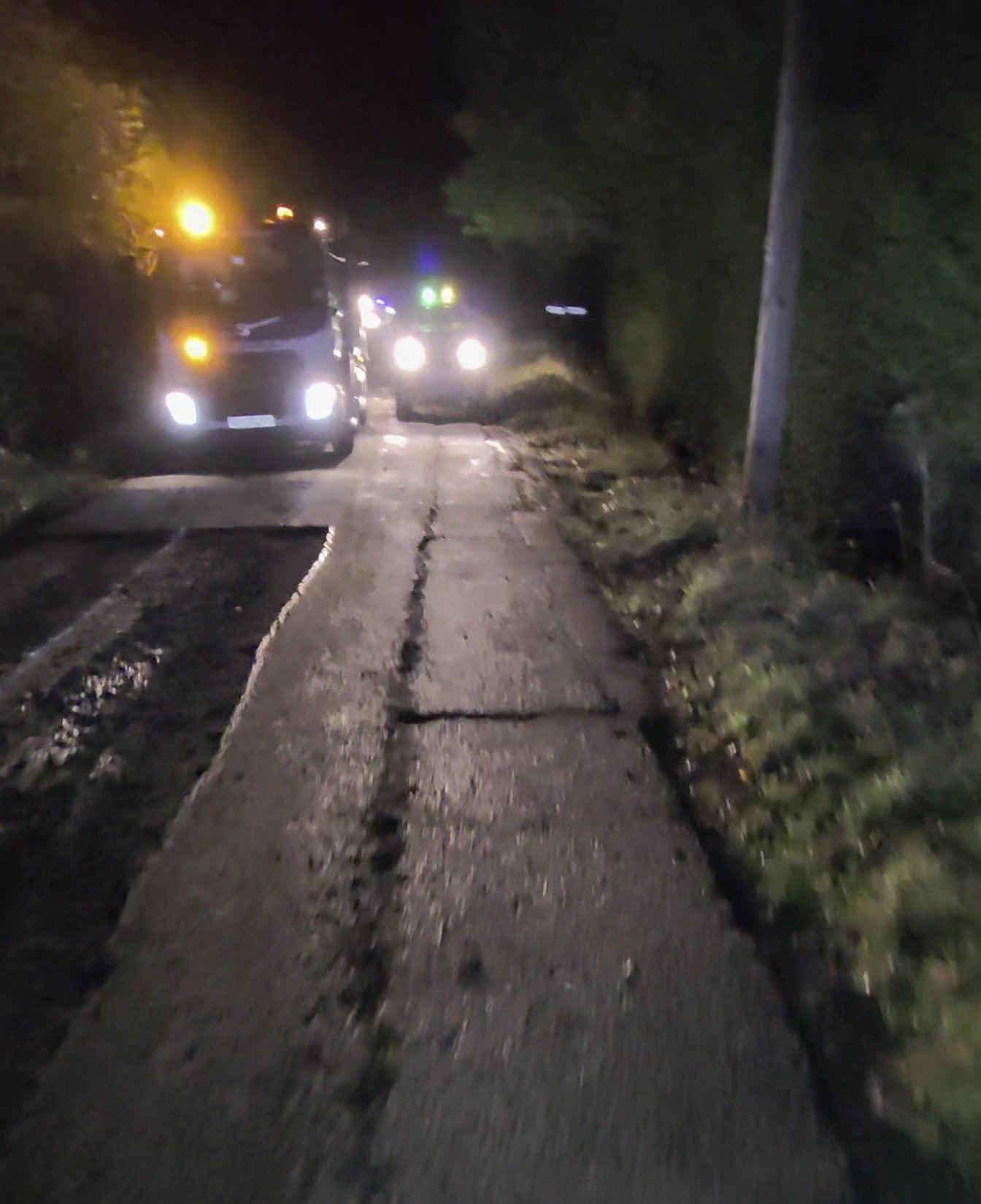
Cradducks Lane, just outside Staplehurst, is getting an upgrade: a night crew in orange hi-vis was out with lorries and machinery and long strips of the old surface were already dug out, so I got off and walked past on the cracked strip that was left. From there it was Underlyn Lane and Pattenden Lane, with just 15 vehicles passing me over the whole 75 km.
That left Hunton Hill, and the steep part of it, 787 m at 8%. Halfway up, the tyre went, and for the first time ever I walked the rest of the hill, then on home. Four weeks later I’d take that same steep part in 3:57, with both tyres holding air. First night out for the clear lenses, then, and I saw the last stretch of it at walking pace.
The numbers
- Ride: #1109 on Strava, ride 238 of 2026, day 118 of the streak
- Distance: 74.9 km
- Moving time: 3:19:26 (3:25:09 elapsed)
- Elevation: 349 m
- Average power: 118 W
- Heart rate: 99 bpm average, 140 max
- Cadence: 87 rpm average
- Calories: 1,682 kcal
- Highlight (Garmin climb): Hunton Hill – 0.79 km, 64 m, 6:16, with a puncture
- Conditions: dark, 11°C (feels like 5°C), 87% humidity, NNW wind at 26 km/h
- Year to date: Distance 19,186 km, Elevation Gain 198,131 m
The route
● Favourite Garmin segment ● Shorter segment inside a longer one The numbers match the Segments table below. Hover over a segment for its time and rank; click or tap for a link to it on Garmin Connect.
Download the GPX (start and finish trimmed for privacy)
11 favourite Garmin segments. Best placed: Collier St School to Sheephurst, 1.51 km at -0.1%, 13th of my 31 goes (from km 10). Time and power are from this ride; My rank places this ride among all my own goes at that segment. The numbers match the map, and each segment name links to Garmin Connect, where you can save it (you’ll need a Garmin account).
Segments table
| # | Segment | Starts at km | Length | Ascent | Avg grade | Time | Avg speed | Avg power | My rank | My best |
|---|---|---|---|---|---|---|---|---|---|---|
| 1 | Hunton Hill Down | 0.9 | 0.79 km | 0 m | -8.0% | 1:06 | 43.2 km/h | 40 W | 32 of 39 | 0:47 |
| 2 | Hunton 2 Yalding | 1.7 | 2.60 km | 1 m | -1.3% | 5:16 | 29.7 km/h | 163 W | 63 of 82 | 4:00 |
| 3 | Yalding to Collier St | 5.8 | 4.57 km | 17 m | 0.1% | 10:24 | 26.4 km/h | 198 W | 9 of 14 | 9:18 |
| 4 | Collier St School to Sheephurst | 10.4 | 1.51 km | 3 m | -0.1% | 3:22 | 27.0 km/h | 225 W | 13 of 31 | 2:34 |
| 5 | Sheephurst Lane | 12.0 | 3.14 km | 15 m | 0.2% | 8:01 | 23.5 km/h | 207 W | 24 of 31 | 5:26 |
| 6 | Staplehurst to Headcorn | 22.7 | 6.28 km | 33 m | -0.1% | 15:12 | 24.8 km/h | 215 W | 10 of 15 | 11:30 |
| 7 | Smarden/Headcorn Road Sprint | 30.1 | 3.51 km | 15 m | 0.0% | 9:19 | 22.6 km/h | 192 W | 23 of 27 | 5:53 |
| 8 | Smarden Road Sprint | 30.2 | 2.27 km | 11 m | 0.1% | 6:07 | 22.2 km/h | 196 W | 22 of 27 | 3:43 |
| 9 | Staplehurst – Marden | 62.5 | 2.21 km | 4 m | -0.2% | 6:42 | 19.8 km/h | 194 W | 7 of 7 | 4:50 |
| 10 | Pattenden Lane Sprint | 66.9 | 0.67 km | 0 m | -0.5% | 1:32 | 26.5 km/h | 190 W | 19 of 30 | 0:56 |
| 11 | Pattenden Lane | 66.9 | 1.01 km | 0 m | -0.4% | 2:26 | 25.0 km/h | 180 W | 21 of 30 | 1:26 |
The profile and climbs
1 climb, uncategorised: 0.79 km at 8%, 64 m of climbing (from km 73). That is Hunton Hill near the end of the ride, and its time is slow because of the puncture. Garmin and Strava measure climbs and segments over their own start and finish points, so the figures here can differ from the Highlight above and from each other.
Uncategorised The pin marks where the Garmin ClimbPro climb starts. Hover or tap it for details.
Climbs table
| # | Climb | Category | Starts at km | Length | Ascent | Avg grade | Time | Avg speed | Avg power | My rank | My best |
|---|---|---|---|---|---|---|---|---|---|---|---|
| 1 | Hunton Hill | Uncategorised | 73.4 | 0.79 km | 64 m | 8% | 6:16 | 7.5 km/h | 222 W | – | – |
My rank and My best are left blank on this climb: the puncture threw out the GPS match. Time and speed include the walk.
Related
Related rides
- Colder and Darker to Rye: the next evening, with company and no puncture
- A Mild Night on Babylon Lane: another night out across the Weald to Headcorn and Smarden
Every town, café, beach and landmark from my rides is collected on the Links page.