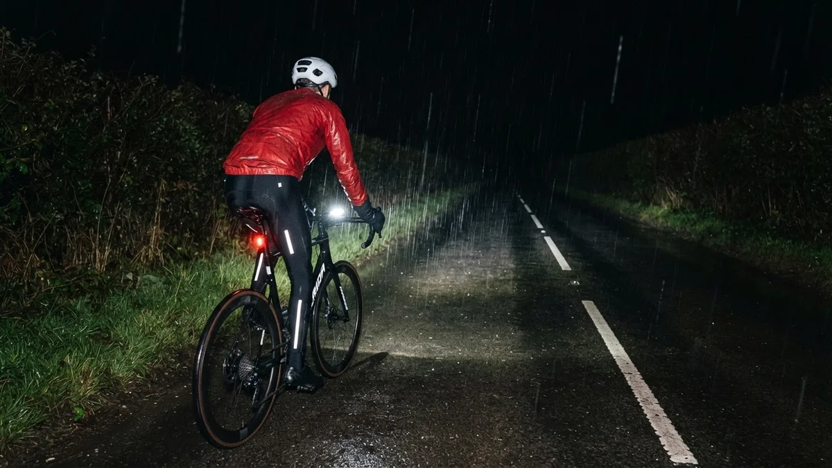
“Rain jacket required” was all I wrote on Strava afterwards, and it just about covers this rainy night ride in Kent. I headed out late into steady rain at 9°C, with 95% humidity and only a faint east-north-easterly, for the loop across the Weald that I’d ridden in the dry a week earlier. The red rain jacket went on before I left.
I went straight down Hunton Hill on wet tarmac, still touching 52 km/h on the way down, and paused for a minute or so at the bottom. Then it was south through Chainhurst and west along Green Lane to Collier Street. From the school there, Sheephurst Lane carried me south-east across the flat to Marden.
Pattenden Lane took me north out of Marden, and Underlyn Lane east to the A229. The roads were close to empty: just six vehicles passed me on the whole ride.
At Stilebridge the road turns up Linton Hill, the long drag up the A229 to Linton that Garmin’s ClimbPro rates Cat 4. On Truck Fly-Bys on Linton Hill I’d ridden this same loop dry, with lorries for company; this time, in the wet, I got round nearly seven minutes quicker. From the crossroads at the top it was the ridge road home: same loop, worse weather, better time.
The numbers
- Ride: #1143 on Strava, ride 272 of 2026, day 152 of the streak
- Distance: 24.9 km
- Moving time: 1:06:16 (1:13:11 elapsed)
- Elevation: 175 m
- Average power: 121 W
- Heart rate: 107 bpm average, 139 max
- Cadence: 95 rpm average
- Calories: 601 kcal
- Highlight (Strava segment): Linton Hill, Linton – 2.71 km, 104 m, 10:45 at 196 W
- Conditions: dark and raining, 9°C, 95% humidity, a light ENE breeze
- Year to date: Distance 21,831 km, Elevation Gain 221,997 m
The route
● Favourite Garmin segment ● Shorter segment inside a longer one The numbers match the Segments table below. Hover over a segment for its time and rank; click or tap for a link to it on Garmin Connect.
Download the GPX (start and finish trimmed for privacy)
11 favourite Garmin segments. Best placed: Green Lane, 1.90 km at 0.0%, 16th of my 24 goes (from km 7). Time and power are from this ride; My rank places this ride among all my own goes at that segment. The numbers match the map, and each segment name links to Garmin Connect, where you can save it (you’ll need a Garmin account).
Segments table
| # | Segment | Starts at km | Length | Ascent | Avg grade | Time | Avg speed | Avg power | My rank | My best |
|---|---|---|---|---|---|---|---|---|---|---|
| 1 | Hunton Hill Down | 0.9 | 0.79 km | 0 m | -8.0% | 1:09 | 41.2 km/h | – | 37 of 41 | 0:47 |
| 2 | Chainhurst Hill | 3.9 | 0.51 km | 9 m | 1.6% | 1:26 | 21.5 km/h | 201 W | 33 of 43 | 0:52 |
| 3 | Green Lane | 6.6 | 1.90 km | 4 m | 0.0% | 4:22 | 26.1 km/h | 187 W | 16 of 24 | 3:07 |
| 4 | Green Lane Sprint West to Longend Lane | 6.7 | 0.77 km | 2 m | -0.2% | 1:44 | 26.6 km/h | 173 W | 16 of 24 | 1:11 |
| 5 | Collier St School to Sheephurst | 8.6 | 1.51 km | 3 m | -0.1% | 3:44 | 24.3 km/h | 208 W | 30 of 34 | 2:34 |
| 6 | Sheephurst Lane | 10.3 | 3.14 km | 15 m | 0.2% | 8:03 | 23.4 km/h | 193 W | 26 of 33 | 5:26 |
| 7 | Sprint to 30 | 13.5 | 0.88 km | 9 m | 0.1% | 2:17 | 23.0 km/h | 182 W | 14 of 17 | 1:18 |
| 8 | Pattenden Lane Sprint | 15.1 | 0.67 km | 0 m | -0.5% | 1:37 | 24.9 km/h | 178 W | 24 of 32 | 0:56 |
| 9 | Pattenden Lane | 15.1 | 1.01 km | 0 m | -0.4% | 2:29 | 24.4 km/h | 166 W | 23 of 32 | 1:26 |
| 10 | Underlyn Lane to Maidstone | 16.2 | 2.10 km | 6 m | 0.2% | 5:15 | 23.9 km/h | 189 W | 4 of 5 | 4:12 |
| 11 | Linton Hill | 19.7 | 2.86 km | 110 m | 3.9% | 11:06 | 15.4 km/h | 224 W | 66 of 76 | 7:47 |
The profile and climbs
1 climb: 1 Cat 4. Biggest: 2.7 km at 3.7%, 101 m of climbing (Cat 4, from km 20). Together the climbs account for 101 m of the ride’s ascent. Garmin and Strava measure climbs and segments over their own start and finish points, so the figures here can differ from the Highlight above and from each other.
● Cat 4 Pins mark where each Garmin ClimbPro climb starts. Hover or tap a pin for details.
Climbs table
| # | Climb | Category | Starts at km | Length | Ascent | Avg grade | Time | Avg speed | Avg power | My rank | My best |
|---|---|---|---|---|---|---|---|---|---|---|---|
| 1 | Linton Hill, Linton | Cat 4 | 19.6 | 2.75 km | 101 m | 3.7% | 10:33 | 15.6 km/h | 193 W | 66 of 76 | 7:20 |
My rank places this ride among my outdoor rides over the same climb on Garmin up to that day, matched by GPS, and My best is the fastest of them at the time. Time and speed include any stop on the climb.
Related
Related rides
- Down Linton, Up Hunton: this loop in reverse, finishing on the steep side of Hunton Hill
- New Shokz Under the Stars: the night before, dry and clear with stars overhead
Every town, café, beach and landmark from my rides is collected on the Links page.