Castle, Climbs and Carvoeiro
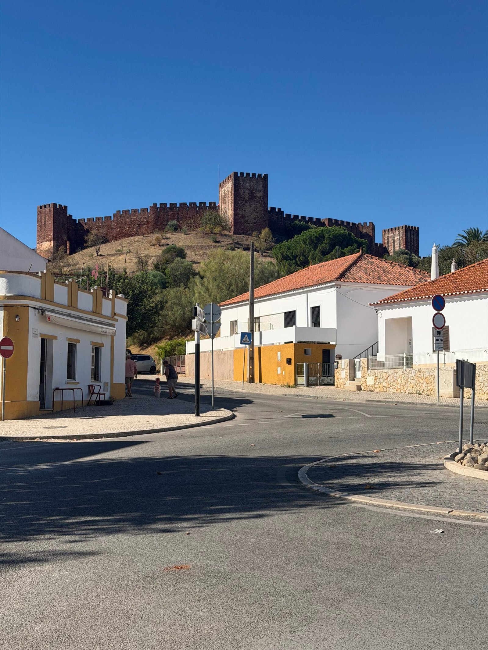
Day five in the Algarve, and on paper a rest day. I’d spent the first few days riding in and out of Silves without ever going up to look at the castle that sits over the town, so I started by putting that right: a few easy kilometres through the streets and then twenty-odd minutes looking around Silves Castle before the day warmed up.
The plan after that was loose: get some hill climbing in while the morning was still fresh, then head for the coast and finish at the beach. It’s an elastic definition of rest, but it’s a holiday, and this was my second so-called rest day of the trip after day three.
From Silves the road heads north into the serra, and it doesn’t take long to start going up. The first proper climb came at 11 km, and from there it was one ramp after another through the cork oaks and dry scrub, with the views opening up over the hills as I gained height. Out past São Marcos da Serra I turned west on the road towards Alferce, where the two longest climbs of the day were waiting.


The hardest of them was the climb past Cansino, over 3 km at nearly 7% with steeper ramps that had me grinding along at a low cadence. Straight after it came the long drag up into Alferce, a village of painted walls and signposts pointing to Monchique and Picota, where I stopped for a breather. Just beyond it the road topped out at a little over 400 m, the high point of the day.
Then the reward: a long, fast descent south off the hills and flatter roads down the valley to Porto de Lagos. I paused there beside a river that the summer had shrunk to a few green pools, then took a longer break a little further on before turning east for Silves.
The way back crossed the Ribeira de Odelouca and followed the valley into Silves, past the river and the old bridge at the foot of the town, and out the other side with a last look back at the white houses climbing the hill.


From there it was south through a short tunnel and on towards Lagoa and the coast. For a holiday area the roads were kind all day: just 297 vehicles passed me in 121 km. By four o’clock I was rolling down to the sea, with big blue letters by the road announcing Praia do Carvoeiro.
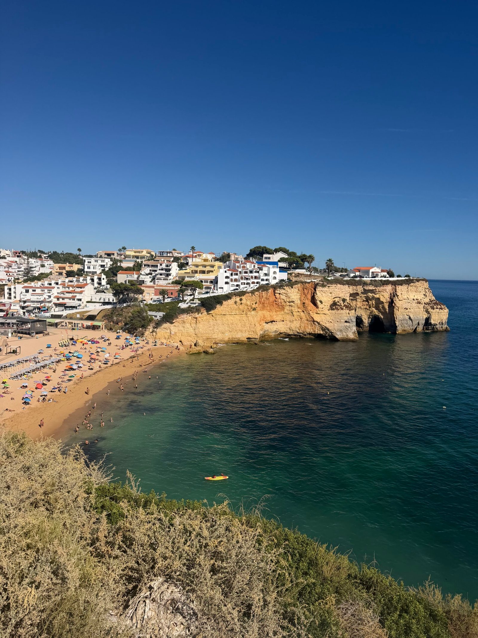
Carvoeiro was everything the postcards promise: a small bay of golden sand tucked between ochre cliffs, and water so clear and turquoise it barely looked real. I spent twenty minutes taking it in, then headed back inland for a short stop in Lagoa and the last 20 km home.


Back at base the tally was 121 km and nearly 1,900 m of climbing, and Garmin reckoned I’d sweated out over 4 litres along the way. A castle, the hills and a beach all in one ride – a strange sort of rest day, but I’m not complaining.
The numbers
- Ride: #1082 on Strava, ride 211 of 2026, day 91 of the streak
- Distance: 121.3 km
- Moving time: 5:52:19 (8:18:25 elapsed)
- Elevation: 1,857 m
- Average power: 130 W
- Heart rate: 106 bpm average, 139 max
- Cadence: 82 rpm average
- Calories: 3,249 kcal
- Highlight: Cansino climb – 3.23 km, 222 m, 18:54 at 191 W
- Conditions: clear and sunny, 19.1°C at the start, 69% humidity, a light northerly breeze
- Year to date: Distance 16,930 km, Elevation Gain 177,164 m
The route
Download the GPX (start and finish trimmed for privacy)
The profile and climbs
20 climbs: 2 Cat 3, 4 Cat 4, 14 uncategorised. Biggest: 4.8 km at 5.6%, 269 m of climbing (Cat 3, from km 46). Together the climbs account for 1,356 m of the ride’s ascent.
Cat 3Cat 4UncategorisedPins mark where each Garmin ClimbPro climb starts. Hover or tap a pin for details.
Climbs table
| # | Starts at km | Length | Ascent | Avg grade | Time | Avg power | Category |
|---|---|---|---|---|---|---|---|
| 1 | 11.1 | 1.88 km | 106 m | 5.6% | 9:46 | 208 W | Cat 4 |
| 2 | 18.8 | 1.33 km | 87 m | 6.5% | 7:05 | 237 W | Cat 4 |
| 3 | 20.8 | 0.56 km | 19 m | 3.3% | 2:03 | 216 W | Uncategorised |
| 4 | 22.1 | 1.77 km | 53 m | 3.0% | 6:01 | 196 W | Uncategorised |
| 5 | 24.3 | 0.51 km | 12 m | 2.3% | 1:30 | 198 W | Uncategorised |
| 6 | 26.2 | 1.31 km | 82 m | 6.3% | 6:14 | 239 W | Cat 4 |
| 7 | 30.8 | 1.62 km | 52 m | 3.2% | 5:41 | 200 W | Uncategorised |
| 8 | 34.3 | 1.75 km | 132 m | 7.5% | 10:37 | 211 W | Cat 4 |
| 9 | 38.6 | 4.85 km | 248 m | 5.1% | 23:43 | 177 W | Cat 3 |
| 10 | 45.9 | 4.82 km | 269 m | 5.6% | 51:24 | 179 W | Cat 3 |
| 11 | 51.2 | 0.51 km | 18 m | 3.6% | 1:38 | 222 W | Uncategorised |
| 12 | 60.2 | 0.64 km | 26 m | 4.0% | 2:33 | 208 W | Uncategorised |
| 13 | 63.6 | 0.85 km | 33 m | 3.9% | 3:17 | 203 W | Uncategorised |
| 14 | 69.2 | 0.78 km | 27 m | 3.5% | 2:27 | 217 W | Uncategorised |
| 15 | 81.0 | 1.16 km | 51 m | 4.4% | 4:20 | 243 W | Uncategorised |
| 16 | 83.0 | 0.60 km | 15 m | 2.5% | 1:56 | 246 W | Uncategorised |
| 17 | 94.0 | 0.61 km | 29 m | 4.7% | 3:20 | 240 W | Uncategorised |
| 18 | 95.7 | 0.54 km | 22 m | 4.2% | 2:22 | 208 W | Uncategorised |
| 19 | 103.3 | 0.91 km | 29 m | 3.2% | 3:11 | 179 W | Uncategorised |
| 20 | 119.7 | 1.55 km | 46 m | 3.0% | 6:05 | 155 W | Uncategorised |
To the Spanish Border and Back

Day four in the Algarve, and the big one. I rolled out of Silves at twenty to seven with a simple plan: ride east along the coast to the Spanish border, then find a way home through the hills. It was cool for once, about 20°C and damp, and the sky was still grey and pink when I passed a ruined windmill on the edge of Ferreiras.
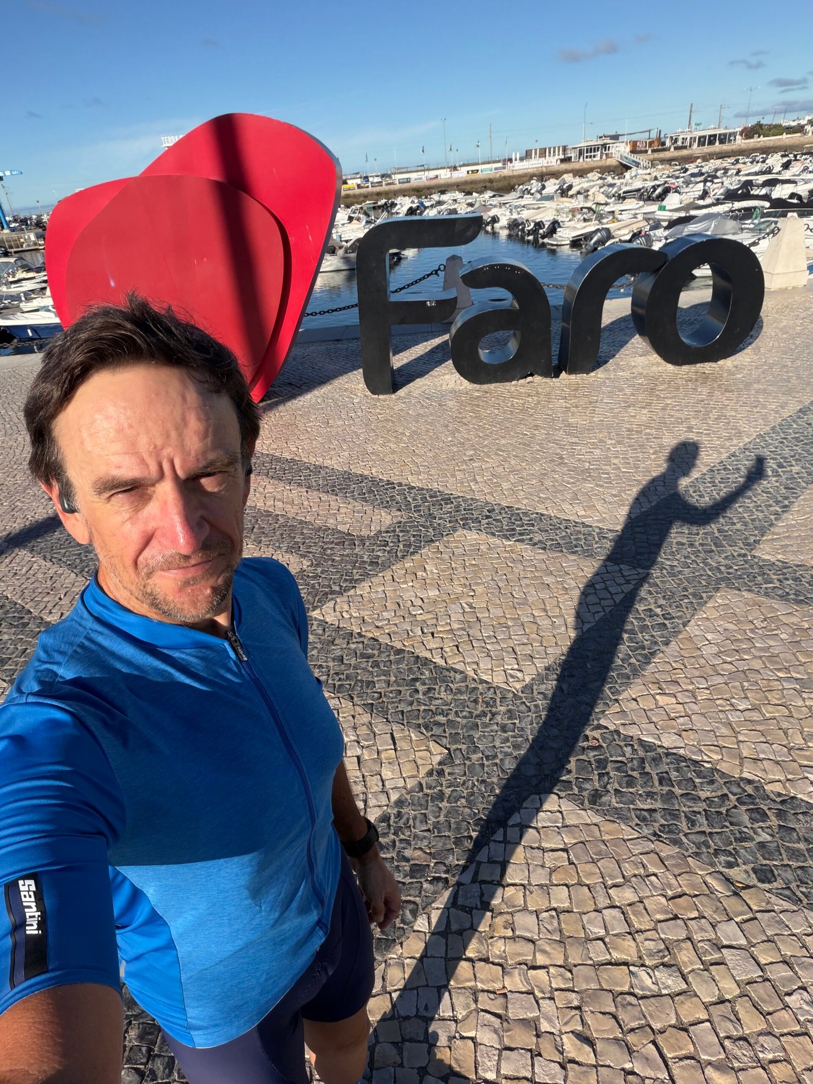
The outbound leg was flat and fast. Through Algoz and Tunes and down to Faro, where I stopped in the square by the marina for a selfie with the town sign and a long break before the next stretch. I was back in the Maglia Azzurra, the Giro’s blue mountains jersey, and the hills on the way home would make me earn it.
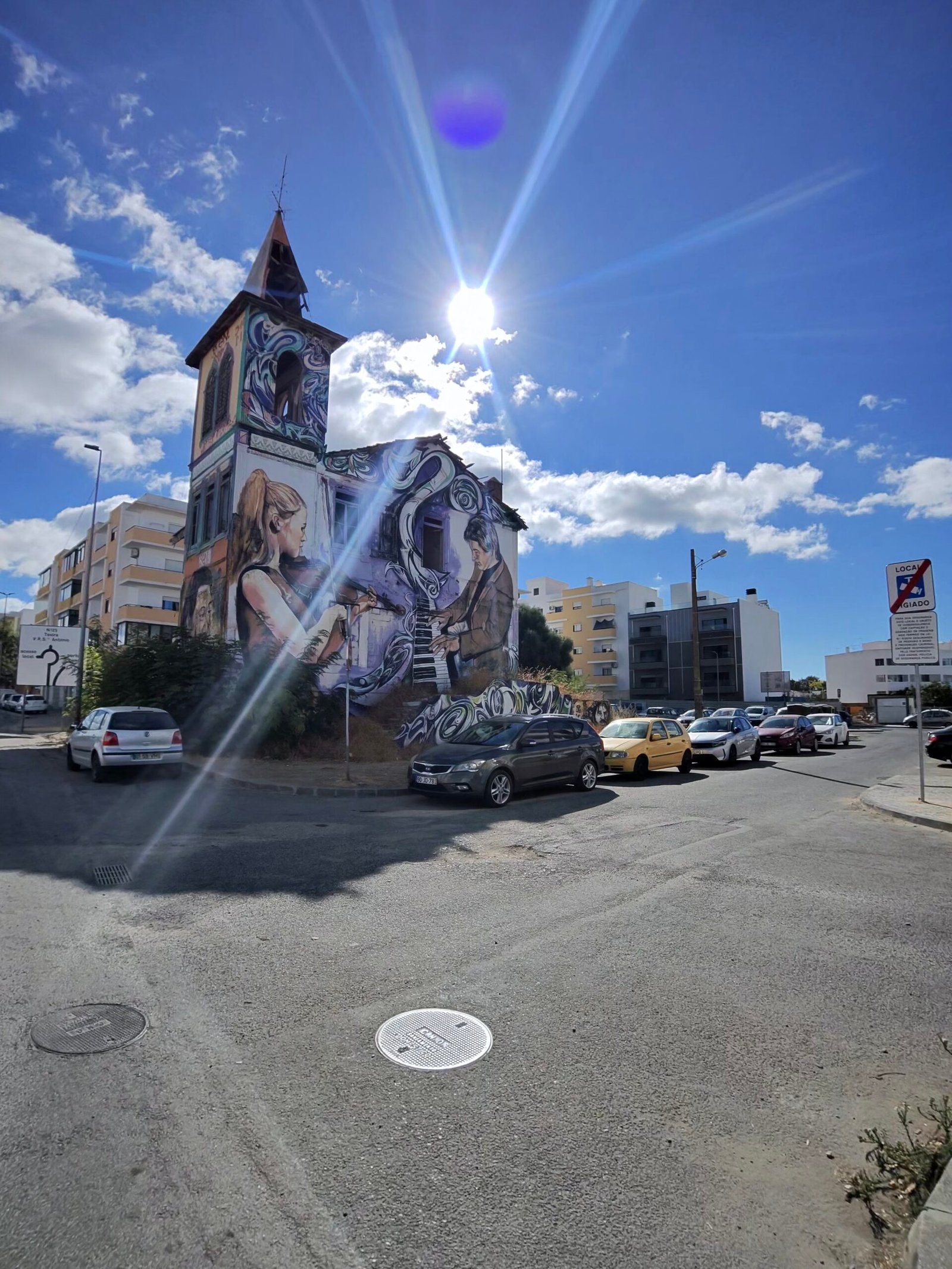
From Faro the N125 ran east through Olhão, past a towered house painted from top to bottom in murals, and on to the white church at Luz de Tavira. A quick pause on the edge of Tavira, then the same easy rhythm through Conceição, Cacela and Altura.
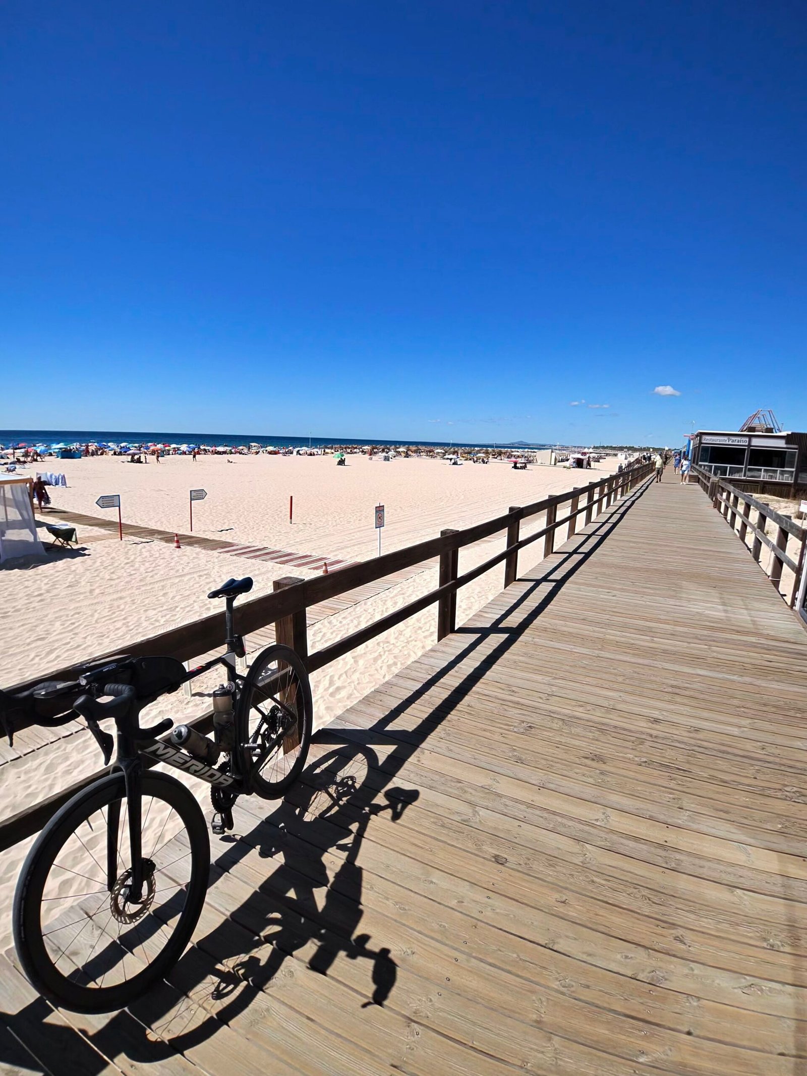
The N125 is not a quiet road: by the end of the day my radar had counted 986 vehicles passing me. But the miles came easily, and at 112 km I reached Monte Gordo and took a long midday stop, the bike leaning on the boardwalk above the beach.
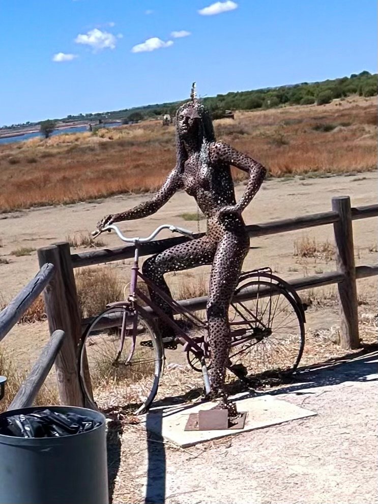
From there it was a few kilometres along the front to Vila Real de Santo António, its lighthouse and the Guadiana, with Spain just across the water. Then I turned north past the salt marshes of Castro Marim, where a metal woman on a bicycle keeps watch by the path. It was the only real turning point of the day: from here every road led back west and, as I was about to find out, uphill.



That was where the ride changed. Inland from Castro Marim the road climbed towards the Beliche reservoir, low and blue under a hard sky, and into the empty hills behind it. Most of the day’s climbing was still to come.
The steepest pitch came at 143 km, the wall up to Corte do Gago – 90 m of height in 800 m, with my heart rate at its highest of the day – and after that the climbs just kept coming, through Carrapateira and down the long valleys towards Tavira.
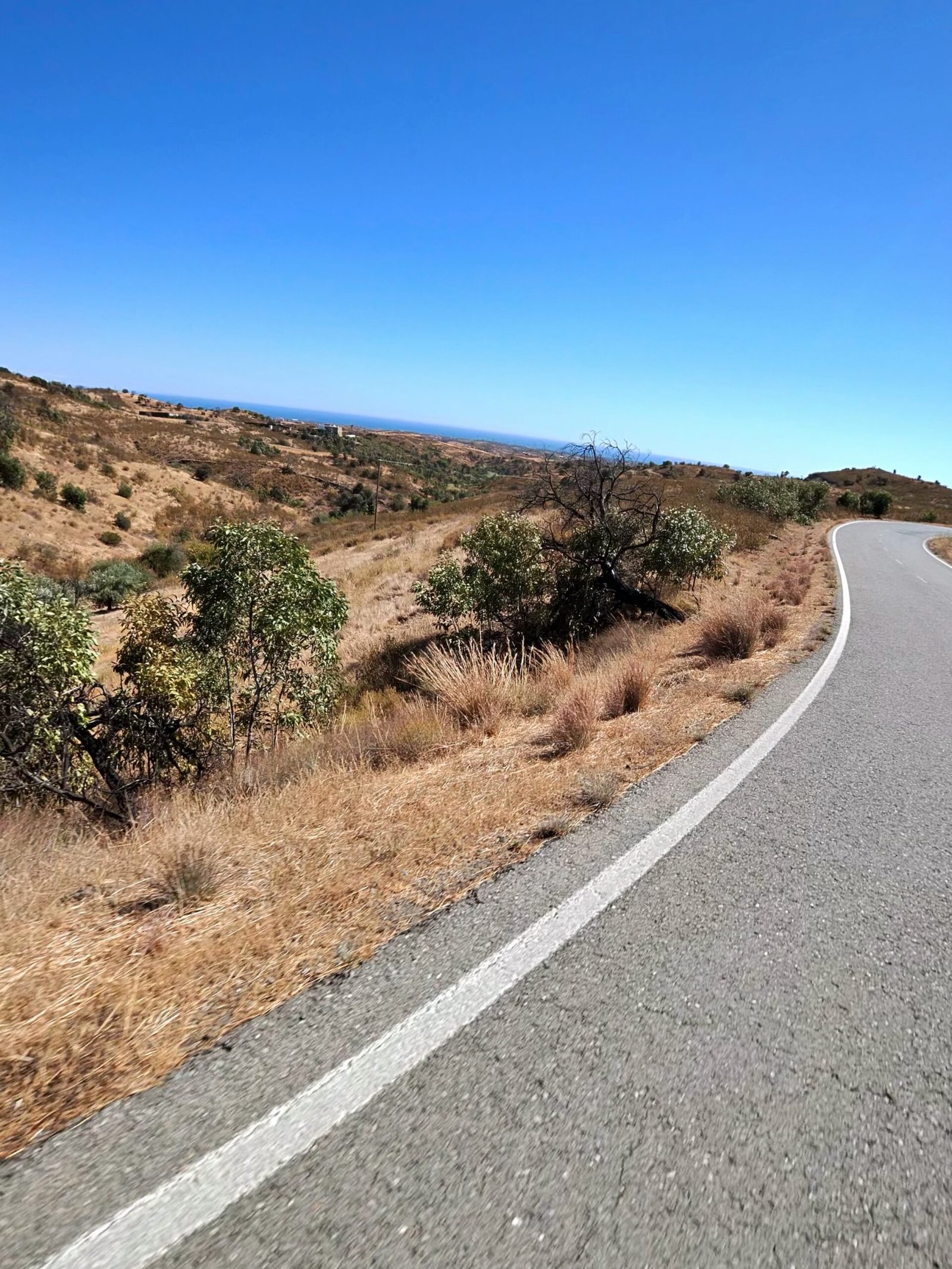
It was hot, dry and very quiet out there. An old maroon Renault 4 sat in the grass near Monte Novo, and from the ridges the sea was only a faint line far to the south. My verdict on Strava afterwards summed it up: the outbound was flat, fast and cooler, the return hilly, desolate and hot.



Asseca and São Brás de Alportel each earned a stop, and each time it was harder to get going again. The last real climb was up to Alto Fica, the sun already low over the road, then a final break in Benafim before the run home through Alte and Messines.
I rolled back into Silves at nine in the evening, more than fourteen hours after leaving, with 256 km on the clock – the longest ride of the trip so far. Garmin reckoned I’d sweated out more than six and a half litres along the way. Out to the border on the flat, home the hard way through the hills – a proper day’s work.
The numbers
- Ride: #1081 on Strava, ride 210 of 2026, day 90 of the streak
- Distance: 255.8 km
- Moving time: 11:02:56 (14:20:22 elapsed)
- Elevation: 2,625 m
- Average power: 114 W
- Heart rate: 100 bpm average, 143 max
- Cadence: 85 rpm average
- Calories: 5,784 kcal
- Highlight: Steep bit to Corte do Gago – 0.80 km, 90 m, 5:46 at 263 W
- Conditions: partly cloudy, 20.6°C at the start, 88% humidity, light NNW breeze (about 12 km/h)
- Year to date: Distance 16,809 km, Elevation Gain 175,307 m
The route
Download the GPX (start and finish trimmed for privacy)
The profile and climbs
25 climbs: 7 Cat 4, 18 uncategorised. Biggest: 2.9 km at 4.9%, 143 m of climbing (Cat 4, from km 143). Together the climbs account for 1,258 m of the ride’s ascent.
Cat 4 Uncategorised Pins mark where each Garmin ClimbPro climb starts. Hover or tap a pin for details.
Climbs table
| # | Starts at km | Length | Ascent | Avg grade | Time | Avg power | Category |
|---|---|---|---|---|---|---|---|
| 1 | 0.8 | 0.23 km | 3 m | 1.4% | 0:35 | 86 W | Uncategorised |
| 2 | 3.2 | 1.80 km | 72 m | 4% | 6:50 | 207 W | Uncategorised |
| 3 | 9.4 | 0.51 km | 16 m | 3.1% | 1:27 | 228 W | Uncategorised |
| 4 | 18.7 | 0.78 km | 23 m | 3% | 2:24 | 190 W | Uncategorised |
| 5 | 126.0 | 1.74 km | 83 m | 4.8% | 8:02 | – | Cat 4 |
| 6 | 128.0 | 1.33 km | 41 m | 3% | 4:58 | 195 W | Uncategorised |
| 7 | 135.1 | 2.90 km | 97 m | 3.3% | 11:52 | 179 W | Cat 4 |
| 8 | 140.7 | 0.72 km | 19 m | 2.6% | 2:43 | 172 W | Uncategorised |
| 9 | 142.9 | 2.90 km | 143 m | 4.9% | 14:20 | 189 W | Cat 4 |
| 10 | 146.6 | 0.65 km | 20 m | 3% | 2:29 | 180 W | Uncategorised |
| 11 | 149.0 | 1.66 km | 85 m | 5.1% | 7:28 | 198 W | Cat 4 |
| 12 | 152.2 | 1.74 km | 85 m | 4.9% | 8:42 | 174 W | Cat 4 |
| 13 | 159.6 | 0.50 km | 12 m | 2.4% | 1:42 | 191 W | Uncategorised |
| 14 | 162.3 | 0.50 km | 12 m | 2.4% | 1:44 | 188 W | Uncategorised |
| 15 | 164.3 | 0.61 km | 19 m | 3.2% | 2:13 | 194 W | Uncategorised |
| 16 | 165.7 | 0.80 km | 19 m | 2.4% | 2:38 | 185 W | Uncategorised |
| 17 | 171.7 | 0.51 km | 12 m | 2.4% | 1:46 | 164 W | Uncategorised |
| 18 | 174.3 | 1.62 km | 60 m | 3.7% | 5:38 | 206 W | Uncategorised |
| 19 | 204.6 | 0.59 km | 22 m | 3.7% | 2:22 | 199 W | Uncategorised |
| 20 | 212.5 | 2.61 km | 102 m | 3.9% | 10:30 | 207 W | Cat 4 |
| 21 | 219.3 | 2.84 km | 138 m | 4.8% | 13:37 | 201 W | Cat 4 |
| 22 | 224.1 | 1.98 km | 72 m | 3.6% | 7:51 | 184 W | Uncategorised |
| 23 | 236.5 | 0.99 km | 29 m | 2.9% | 3:25 | 222 W | Uncategorised |
| 24 | 244.3 | 0.84 km | 25 m | 3% | 2:21 | 229 W | Uncategorised |
| 25 | 254.4 | 1.41 km | 49 m | 3.4% | 4:56 | 219 W | Uncategorised |
A Rest Day in the Hills

Day three in the Algarve was supposed to be a rest day. After two big days out west I planned something shorter and inland, heading east from Silves into the hills between the coast and the serra. I rolled out just before quarter to eleven on a clear morning that was already 24°C, and it only got hotter.
The first stretch was the easy bit: down out of Silves and across flat farmland to Algoz, where I took a half-hour break before the riding proper began. From there the road wound east to Paderne, and soon after that it started to climb.
The climb up to Alto da Picota was the hardest of the day and the bit I hadn’t really bargained for: just over 1.5 km at around 8%, ten minutes well above the Zone 2 I’d promised myself, with the top at about 310 m. In that heat it felt a lot longer, and by the end of the day Garmin reckoned I’d sweated out over 4 litres – a lot for a rest day. The long descent off Picota was a welcome breather, and after a rattle over the railway the road ran on towards Loulé.

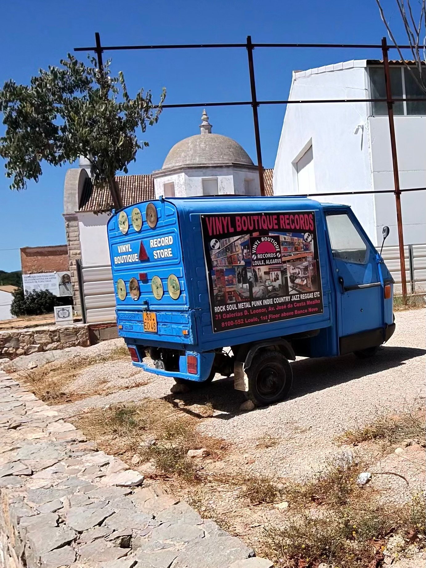
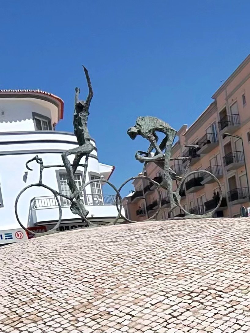
Loulé was the far end of the loop and the main stop of the day. On the way in I passed a little blue three-wheeler doing duty as a rolling advert for a vinyl record shop, then a roundabout topped with statues of cyclists, which felt like a proper welcome.
I stopped for 40 minutes in the old town to refuel, with the castle walls just round the corner, before heading north out of town for the second half of the loop.
Refuelled, I climbed to Querença and on up to Eira da Cevada, a long, steady drag rather than a wall, and at around 350 m the highest point of the ride, 60 km in. Then it was west through the hills above Salir and Benafim, where the road kept rising and falling far more than I’d expected. So much for an easy day. Just short of Alte I passed a wall hung with rusty chainsaw chains.


In Alte I found the Germano biciArte Café, a café made for cyclists: a bike on the wall outside, and inside a white track bike mounted on a Portuguese flag, yellow jerseys and old bike wheels turned into ceiling lights. It’s named after the owner’s grandfather, who rented out bikes on the same spot back in the 1930s. I made the most of it and stayed for over an hour. It was a rest day, after all.
From Alte the road dropped west through São Bartolomeu de Messines towards home, but I had one more detour in mind. The Arade Dam turned out to be the cherry on the cake: blue water stretching away between the hills, with the low sun glinting off it.


The last few kilometres dropped back down towards Silves, over the water at the edge of town with the sun nearly on the horizon, more than eight hours after I’d set off. The roads had been quiet all day, too: just 200 vehicles passed me in nearly 118 km. For a rest day it had over 1,500 m of climbing in it, but with three long stops it never felt like a slog, just a lot hotter than any rest day should be. Just as well, because tomorrow’s plan was a long one: east towards Spain.
The numbers
- Ride: #1080 on Strava, ride 209 of 2026, day 89 of the streak
- Distance: 117.6 km
- Moving time: 5:49:35 (8:13:48 elapsed)
- Elevation: 1,541 m
- Average power: 109 W
- Heart rate: 103 bpm average, 153 max
- Cadence: 82 rpm average
- Calories: 2,768 kcal
- Highlight: Alto da Picota climb – 1.54 km, 130 m, 10:05 at 218 W
- Conditions: clear and hot, 24.1°C at the start, 61% humidity, northerly breeze (about 16 km/h)
- Year to date: Distance 16,553 km, Elevation Gain 172,682 m
The route
Download the GPX (start and finish trimmed for privacy)
The profile and climbs
20 climbs: 3 Cat 4, 17 uncategorised. Biggest: 1.8 km at 7.1%, 124 m of climbing (Cat 4, from km 34). Together the climbs account for 902 m of the ride’s ascent.
Cat 4UncategorisedPins mark where each Garmin ClimbPro climb starts. Hover or tap a pin for details.
Climbs table
| # | Starts at km | Length | Ascent | Avg grade | Time | Avg power | Category |
|---|---|---|---|---|---|---|---|
| 1 | 2.0 | 2.77 km | 89 m | 3.2% | 10:55 | 170 W | Cat 4 |
| 2 | 9.1 | 0.54 km | 14 m | 2.6% | 1:55 | 158 W | Uncategorised |
| 3 | 25.8 | 1.86 km | 71 m | 3.8% | 8:10 | 171 W | Uncategorised |
| 4 | 31.0 | 0.83 km | 36 m | 4.3% | 3:24 | 194 W | Uncategorised |
| 5 | 34.1 | 1.75 km | 124 m | 7.1% | 10:13 | 216 W | Cat 4 |
| 6 | 40.5 | 1.39 km | 37 m | 2.7% | 5:29 | 168 W | Uncategorised |
| 7 | 45.1 | 0.51 km | 19 m | 3.7% | 2:12 | 154 W | Uncategorised |
| 8 | 48.3 | 1.04 km | 38 m | 3.7% | 4:02 | 208 W | Uncategorised |
| 9 | 54.5 | 1.48 km | 62 m | 4.2% | 6:32 | 175 W | Uncategorised |
| 10 | 58.3 | 2.45 km | 89 m | 3.7% | 9:37 | 181 W | Cat 4 |
| 11 | 66.5 | 0.75 km | 16 m | 2.2% | 2:37 | 165 W | Uncategorised |
| 12 | 69.0 | 0.51 km | 21 m | 4% | 2:15 | 182 W | Uncategorised |
| 13 | 75.0 | 0.83 km | 42 m | 5.1% | 4:13 | 180 W | Uncategorised |
| 14 | 76.3 | 1.12 km | 30 m | 2.7% | 4:52 | 146 W | Uncategorised |
| 15 | 80.6 | 0.61 km | 41 m | 6.8% | 3:33 | 203 W | Uncategorised |
| 16 | 83.0 | 1.70 km | 52 m | 3% | 8:52 | 138 W | Uncategorised |
| 17 | 85.4 | 0.57 km | 11 m | 1.9% | 1:49 | 137 W | Uncategorised |
| 18 | 97.2 | 1.06 km | 31 m | 2.9% | 4:20 | 162 W | Uncategorised |
| 19 | 112.0 | 0.69 km | 27 m | 3.9% | 2:41 | 196 W | Uncategorised |
| 20 | 116.2 | 1.49 km | 52 m | 3.5% | 5:19 | 219 W | Uncategorised |
Cork Trees, Turbines and Cobbles
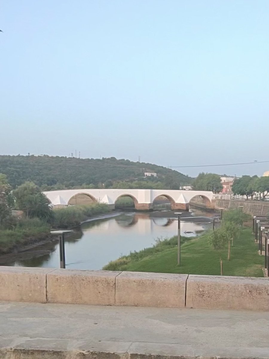
Day two in the Algarve and the alarm did its job: I rolled out of Silves just before seven, past the old bridge over the Arade, on a clear, still morning that was already 23°C. The plan was a big one – north into the Monchique hills, down to the Atlantic coast, round the south-west corner at Vila do Bispo and home along the south coast. After yesterday’s warm-up to the lighthouse, this was where the trip’s first proper climbing would come in.
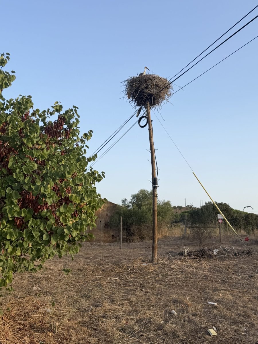
The first 25 km were a gentle way in across flat, sun-dried farmland west of Silves, legs and coffee slowly kicking in. The locals were up early too – a white stork stood guard on an enormous nest perched on top of a telegraph pole.
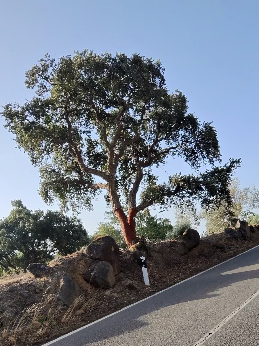
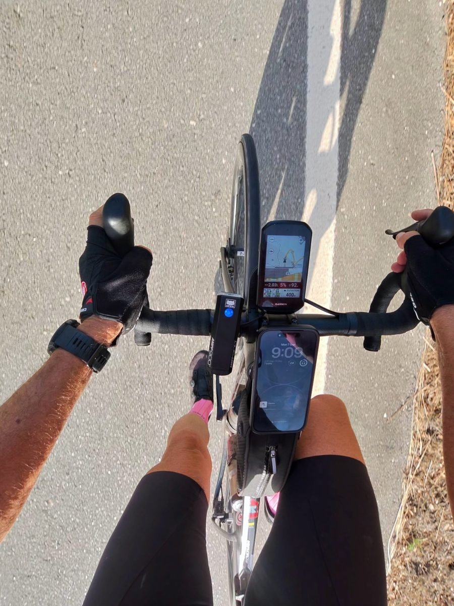
Then the road tipped up, and that’s where the cork trees started. They lined the climb, many with their trunks freshly stripped back to raw red-orange wood where the bark had been harvested – easily one of the highlights of the day.
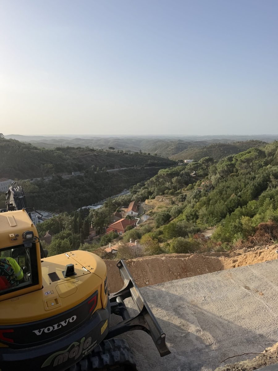
The climb wound up past Caldas de Monchique, where a stretch of road works had a digger parked right on the edge – not a bad spot for it, with a view back down the wooded valley and out across the hills towards the coast.
From Rasmalho the climb up towards Nave goes on for the best part of 12 km, a steady grind with tall trees giving the odd patch of shade. It was the first of the day’s two Cat 3s and the hardest effort of the ride.
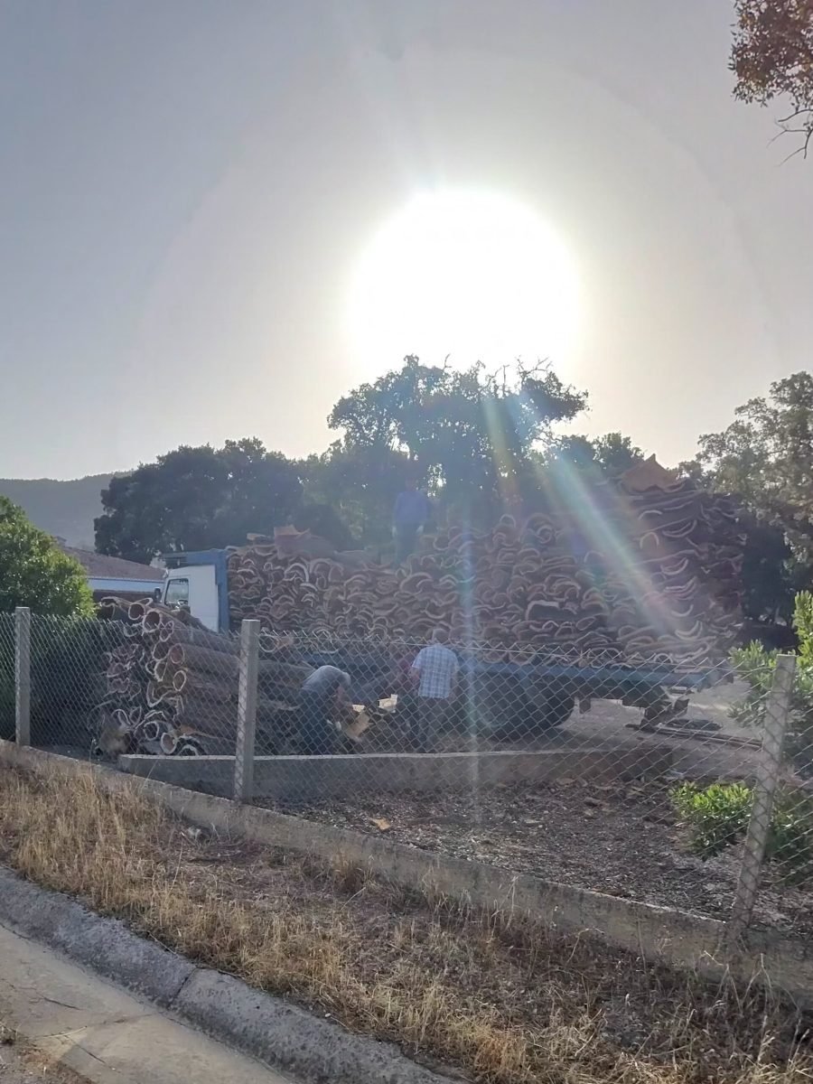
Up in the hills I got to see where all that bark goes: the cork harvest was in full swing, with huge curved slabs of freshly stripped cork piled high and a crew loading it up as the morning sun flared through the trees. Just after nine the Garmin was reading 400 m with about 2 km to go at 5%, and the top came at around 485 m, a little past the 45 km mark.
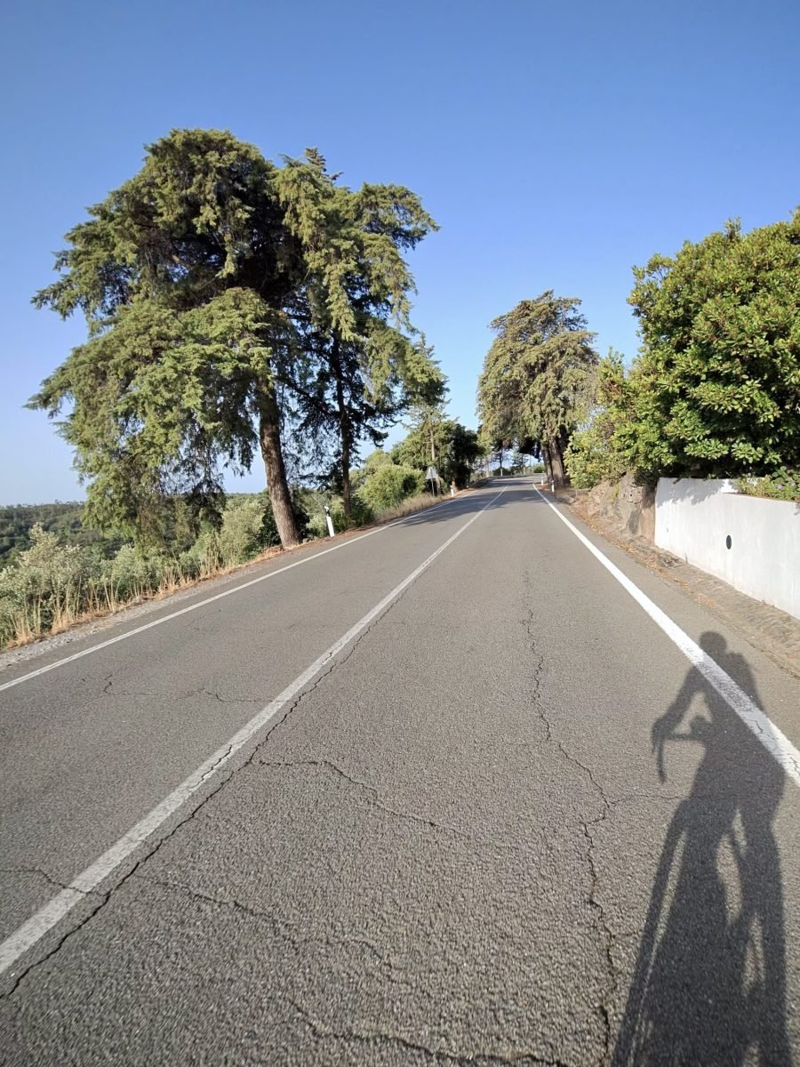
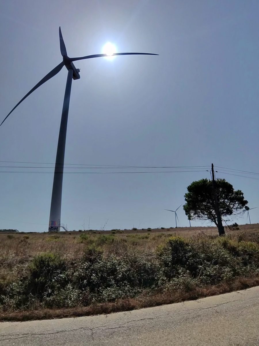
Over the top the road rolled along high ground past Marmelete before a long, fast drop all the way down to Aljezur, near enough sea level. From there it was south along the coast road through Bordeira and Carrapateira, then up the second climb of the day to the wind turbines on the plateau – another highlight, towering over the scrub with the sun sitting right behind the blades.
Vila do Bispo was the far corner of the loop and brought the third highlight: cobbled streets. Not quite Flanders, but enough to rattle the fillings. After a look at the church it was time to point the bike east and start the long road home.
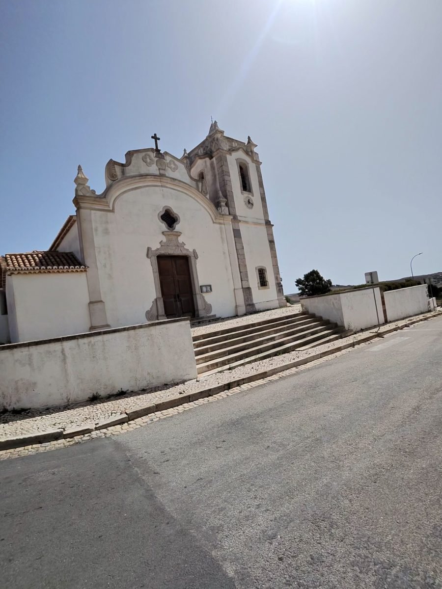
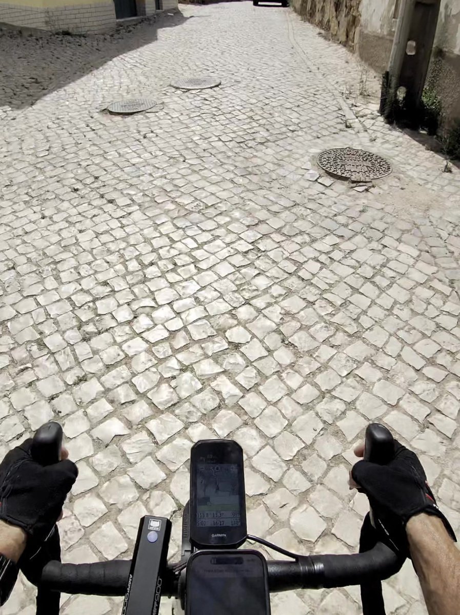
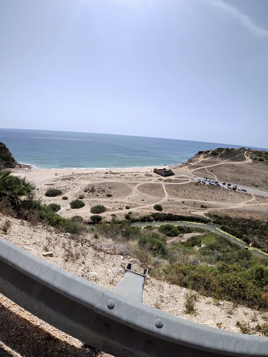
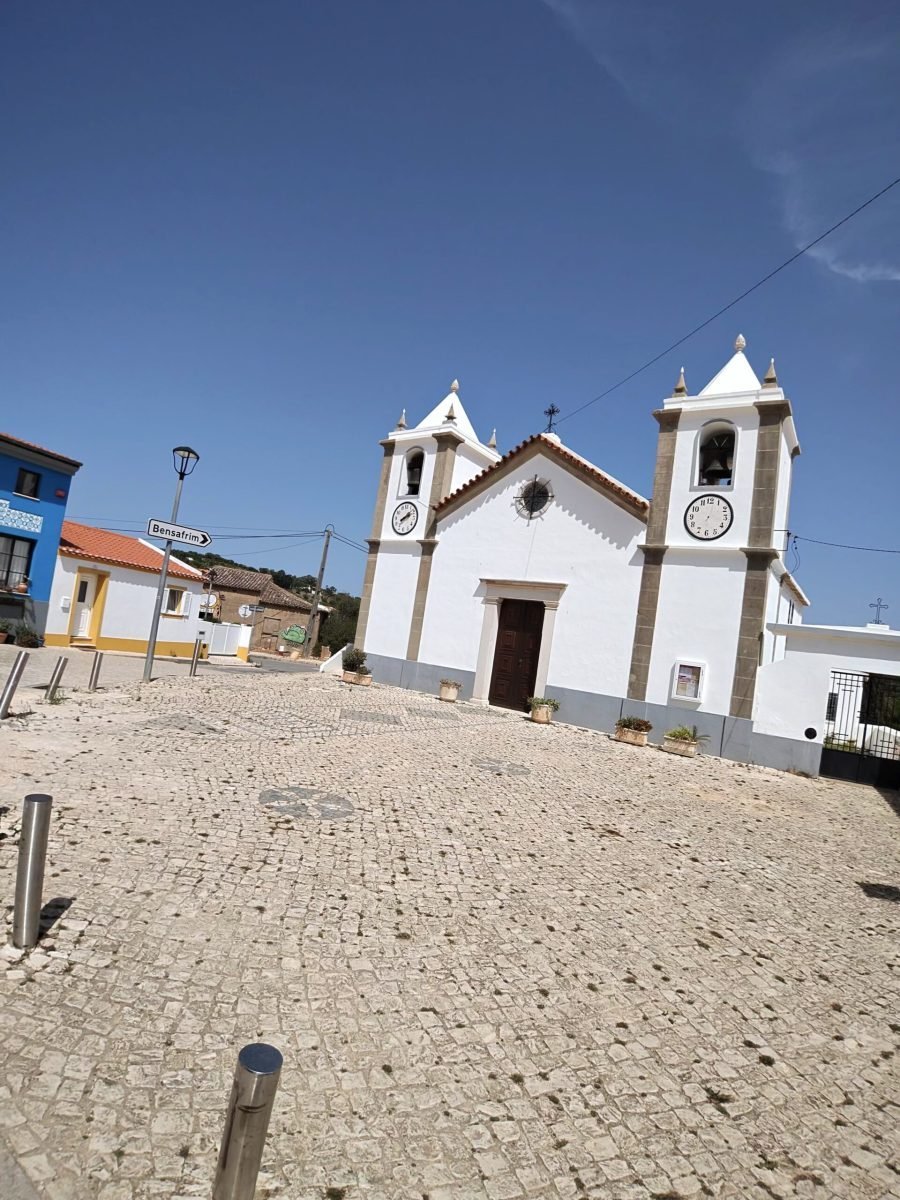
The south coast is anything but flat. Down past Salema, a look over the barrier at the beach at Boca do Rio, then the steep ramp up to Burgau. From there the route ducked inland through the villages towards Bensafrim – more whitewashed churches, more cobbled squares and blissfully quiet roads in the midday sun.
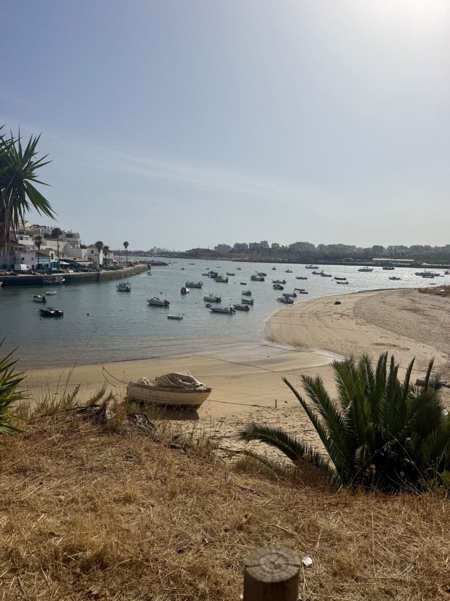
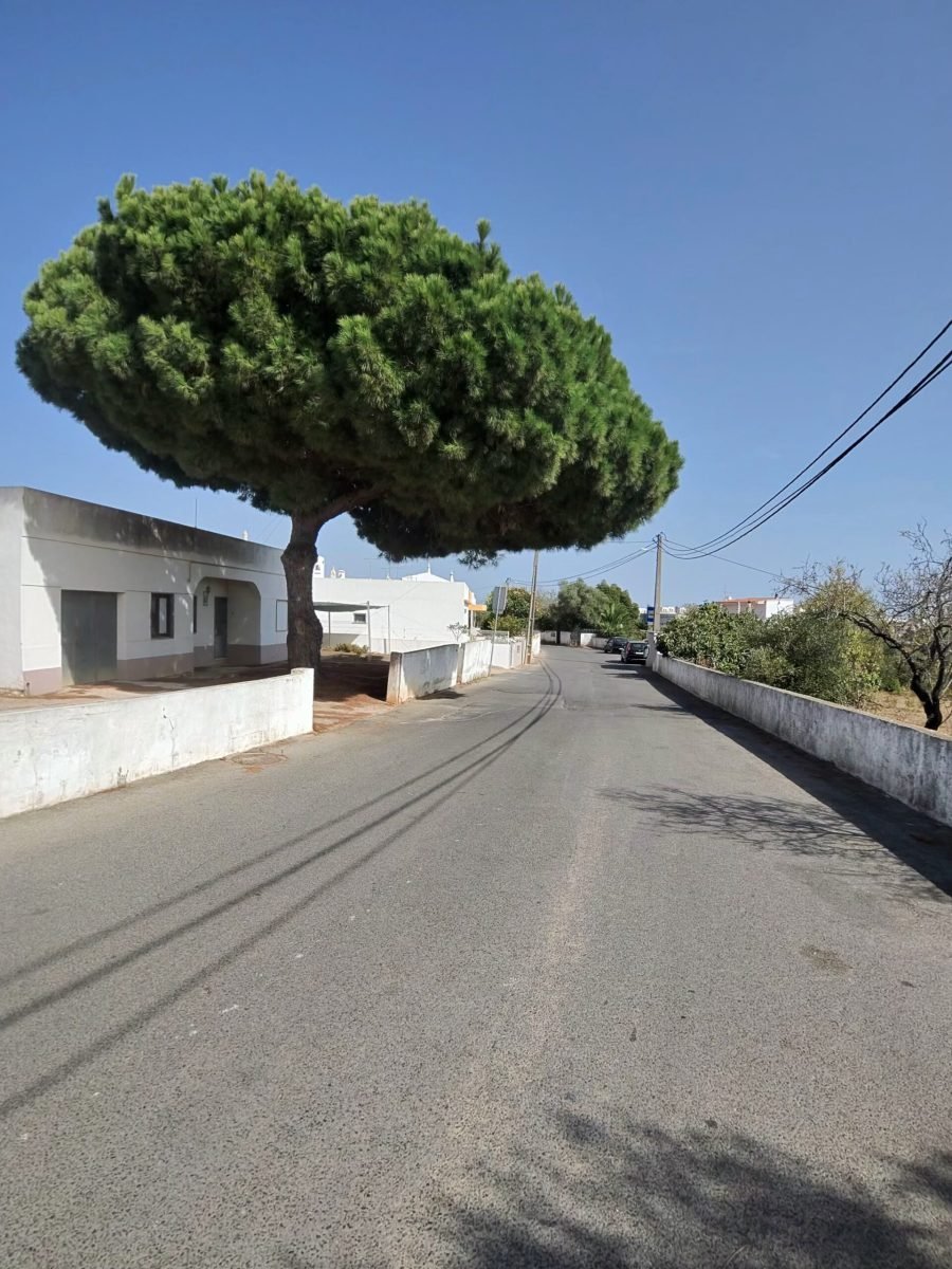
Then it was back down towards the coast through Lagos, Odiáxere and Portimão, with umbrella pines shading the back lanes, and over the Arade to Ferragudo, where the fishing boats sat bobbing in the estuary with Portimão on the far bank. With a few unhurried stops along the way it was a long day in the saddle, and the traffic picked up on this side – 354 vehicles passed me over the day.
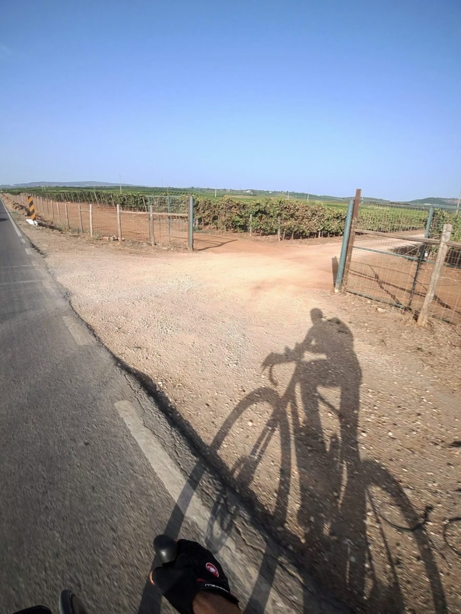
The last leg took me past Porches and Armação de Pêra, then inland through Algoz and up towards Messines, the shadows growing longer beside the vineyards, before the final run back west into Silves – over 200 km, nearly 2,400 m of climbing and, by Garmin’s reckoning, more than 6 litres of sweat in the bank. Day two done, and the legs know they’ve been to the hills.
The numbers
- Ride: #1079 on Strava, ride 208 of 2026, day 88 of the streak
- Distance: 214.8 km
- Moving time: 9:08:21 (11:59:24 elapsed)
- Elevation: 2,392 m
- Average power: 133 W
- Heart rate: 110 bpm average, 159 max
- Cadence: 87 rpm average
- Calories: 5,146 kcal
- Highlight: Rasmalho–Nave climb – 11.9 km, 478 m, 45:06 at 194 W
- Conditions: clear skies, 23.1°C, 60% humidity, light northerly breeze (about 11 km/h)
- Year to date: Distance 16,435 km, Elevation Gain 171,141 m
The route
Download the GPX (start and finish trimmed for privacy)
The profile and climbs
27 climbs: 2 Cat 3, 25 uncategorised. Biggest: 6.9 km at 3.8%, 262 m of climbing (Cat 3, from km 29). Together the climbs account for 1,265 m of the ride’s ascent.
Cat 3UncategorisedPins mark where each Garmin ClimbPro climb starts. Hover or tap a pin for details.
Climbs table
| # | Starts at km | Length | Ascent | Avg grade | Time | Avg power | Category |
|---|---|---|---|---|---|---|---|
| 1 | 0.9 | 0.50 km | 10 m | 2.1% | 1:24 | 155 W | Uncategorised |
| 2 | 19.0 | 1.01 km | 31 m | 3% | 3:03 | 246 W | Uncategorised |
| 3 | 28.6 | 6.89 km | 262 m | 3.8% | 30:13 | 197 W | Cat 3 |
| 4 | 39.1 | 5.48 km | 188 m | 3.4% | 20:59 | 189 W | Cat 3 |
| 5 | 53.0 | 0.73 km | 21 m | 2.8% | 2:16 | 199 W | Uncategorised |
| 6 | 68.6 | 0.92 km | 28 m | 3% | 2:48 | 212 W | Uncategorised |
| 7 | 87.8 | 2.19 km | 66 m | 3% | 6:51 | 209 W | Uncategorised |
| 8 | 102.1 | 0.90 km | 32 m | 3.6% | 3:15 | 199 W | Uncategorised |
| 9 | 106.6 | 0.71 km | 18 m | 2.6% | 2:13 | 220 W | Uncategorised |
| 10 | 109.8 | 0.99 km | 47 m | 4.7% | 4:01 | 235 W | Uncategorised |
| 11 | 111.8 | 1.06 km | 51 m | 4.8% | 4:36 | 227 W | Uncategorised |
| 12 | 118.7 | 0.68 km | 19 m | 2.7% | 2:22 | 199 W | Uncategorised |
| 13 | 120.5 | 0.58 km | 19 m | 3.3% | 2:02 | 221 W | Uncategorised |
| 14 | 122.7 | 1.37 km | 47 m | 3.5% | 4:57 | 200 W | Uncategorised |
| 15 | 127.3 | 0.52 km | 16 m | 3.2% | 2:06 | 163 W | Uncategorised |
| 16 | 136.4 | 1.43 km | 54 m | 3.8% | 5:38 | 190 W | Uncategorised |
| 17 | 156.0 | 0.71 km | 44 m | 6.2% | 3:16 | 252 W | Uncategorised |
| 18 | 164.5 | 0.94 km | 38 m | 4% | 3:24 | 248 W | Uncategorised |
| 19 | 166.3 | 0.62 km | 31 m | 5.1% | 2:44 | 215 W | Uncategorised |
| 20 | 173.8 | 1.16 km | 37 m | 3.2% | 3:55 | 217 W | Uncategorised |
| 21 | 184.3 | 0.76 km | 28 m | 3.7% | 2:58 | 215 W | Uncategorised |
| 22 | 191.6 | 0.52 km | 12 m | 2.3% | 1:22 | 248 W | Uncategorised |
| 23 | 197.0 | 0.57 km | 16 m | 2.9% | 1:41 | 224 W | Uncategorised |
| 24 | 199.3 | 1.84 km | 61 m | 3.3% | 5:49 | 228 W | Uncategorised |
| 25 | 201.9 | 0.56 km | 23 m | 4.2% | 2:11 | 207 W | Uncategorised |
| 26 | 204.2 | 0.58 km | 16 m | 2.8% | 1:51 | 197 W | Uncategorised |
| 27 | 213.3 | 1.47 km | 50 m | 3.4% | 4:53 | 234 W | Uncategorised |
To the Edge of Europe
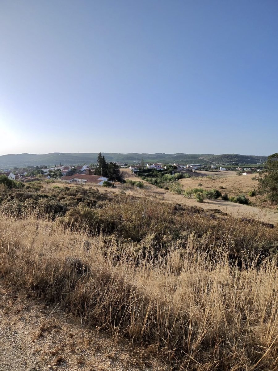
Day one in the Algarve, and the first spin of the wheels in Portugal. I rolled out near Silves just after eight on a clear, still morning, already around 23°C, with one big idea for the day: ride west until the land runs out at Cabo de São Vicente, the lighthouse on the south-western tip of mainland Europe, then come home the long way along the coast. The rustic countryside started straight away: dry golden hills, scrub and whitewashed villages under a deep blue sky.
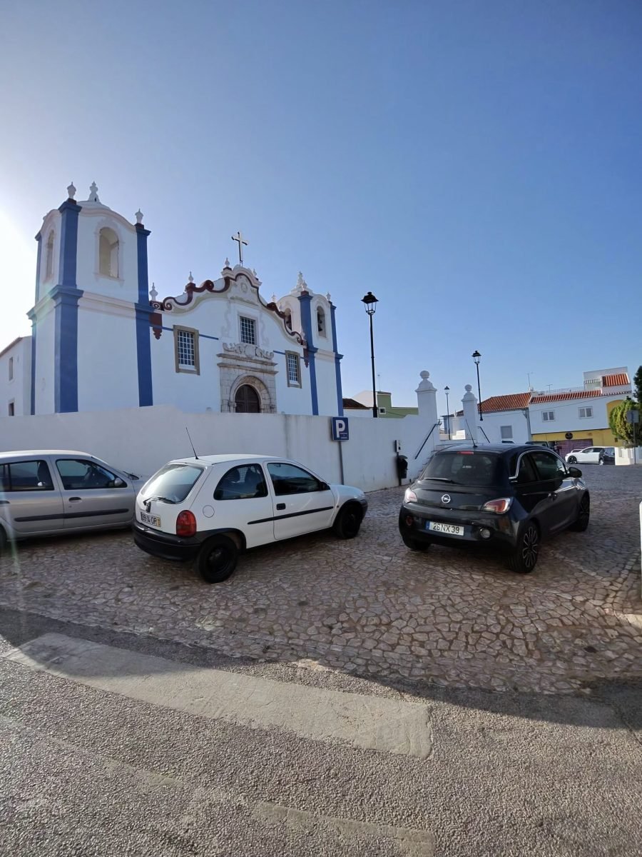
Down past Silves, the road wound between vineyards to Estombar, where the church stood bright white and blue against the sky, then on down to the river at Portimão.
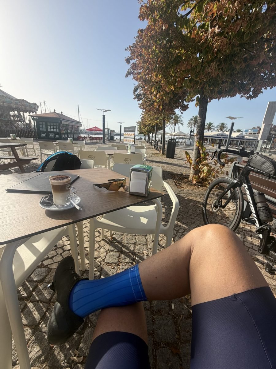
The first proper stop came early. Barely 19 km in, I sat by the river next to the old Arade bridge with a coffee and my legs stretched out in the sun. Not the most efficient start to a 165 km day, but this was a holiday, after all.
Over the bridge it was west through Monte Judeu and Odiáxere and onto the quiet back roads inland of Lagos: red earth verges and long empty lanes around Barão de São João, with barely a car about. My bike radar counted 157 vehicles all day, which over 165 km felt like nothing. The villages got smaller and whiter through Figueira and Raposeira to Vila do Bispo, where the road swings south for Sagres.
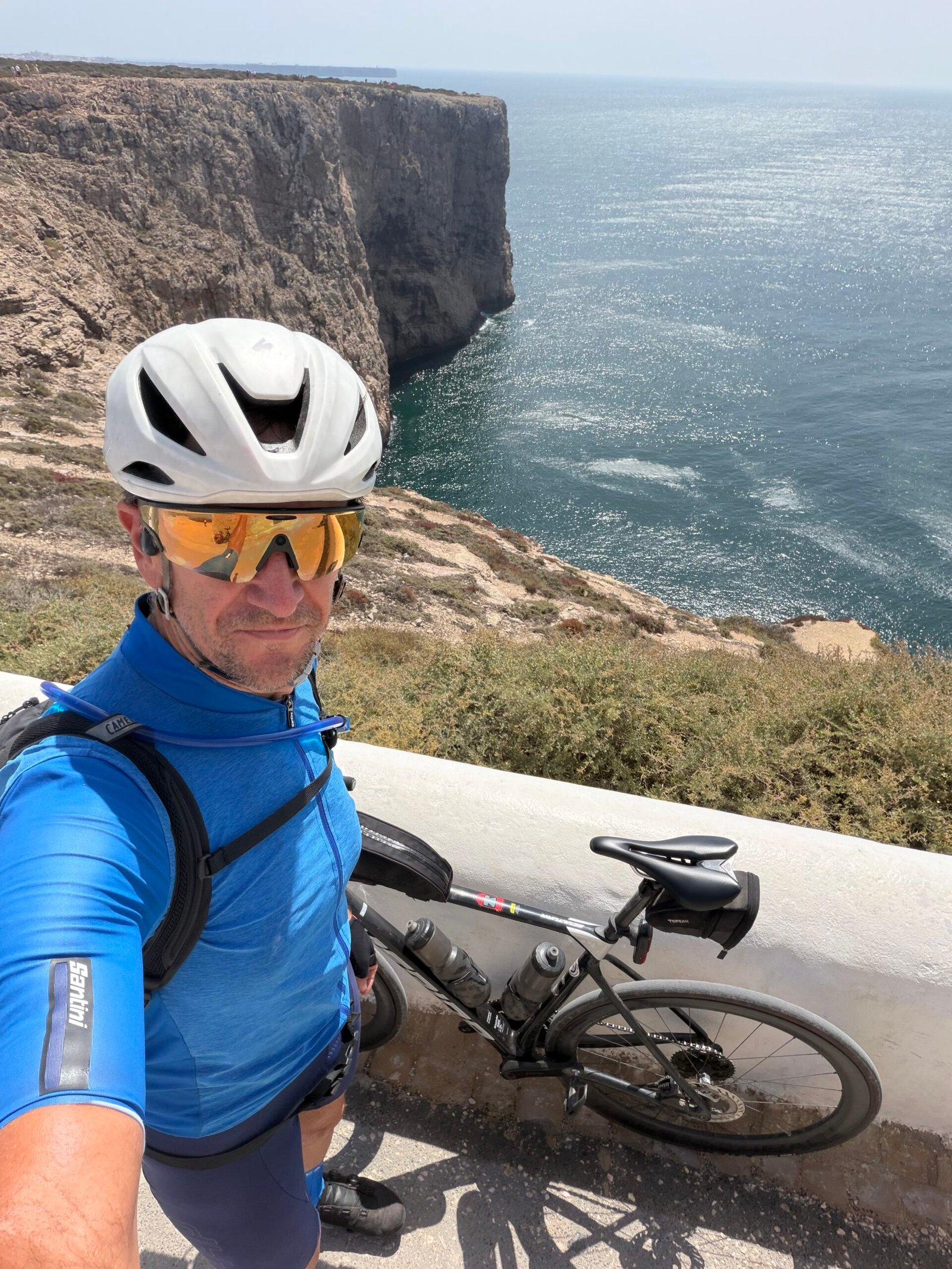
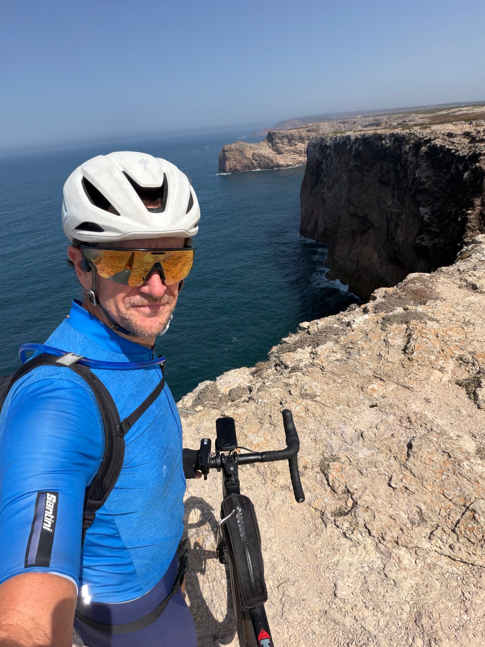
From Sagres it’s a straight run out to the lighthouse along the clifftops, with the Atlantic opening up ahead. I got there just after half past twelve, 78 km in, and spent half an hour taking it all in: sheer cliffs, a vast stretch of blue, and a selfie or three to prove I’d made it to the edge of Europe. I was in sky blue, the colour of the Maglia Azzurra, the Giro’s mountains jersey – a touch ambitious on a day when Garmin didn’t rate a single climb.
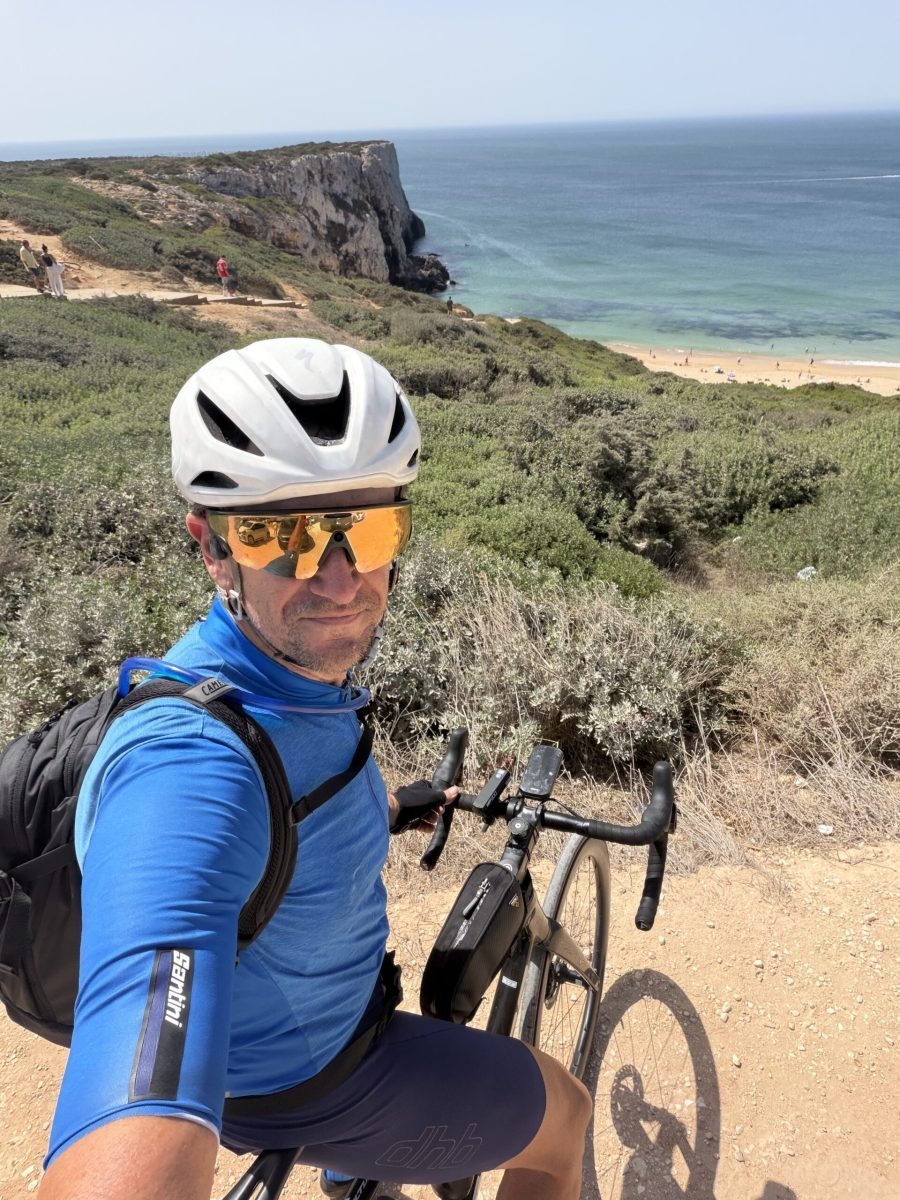
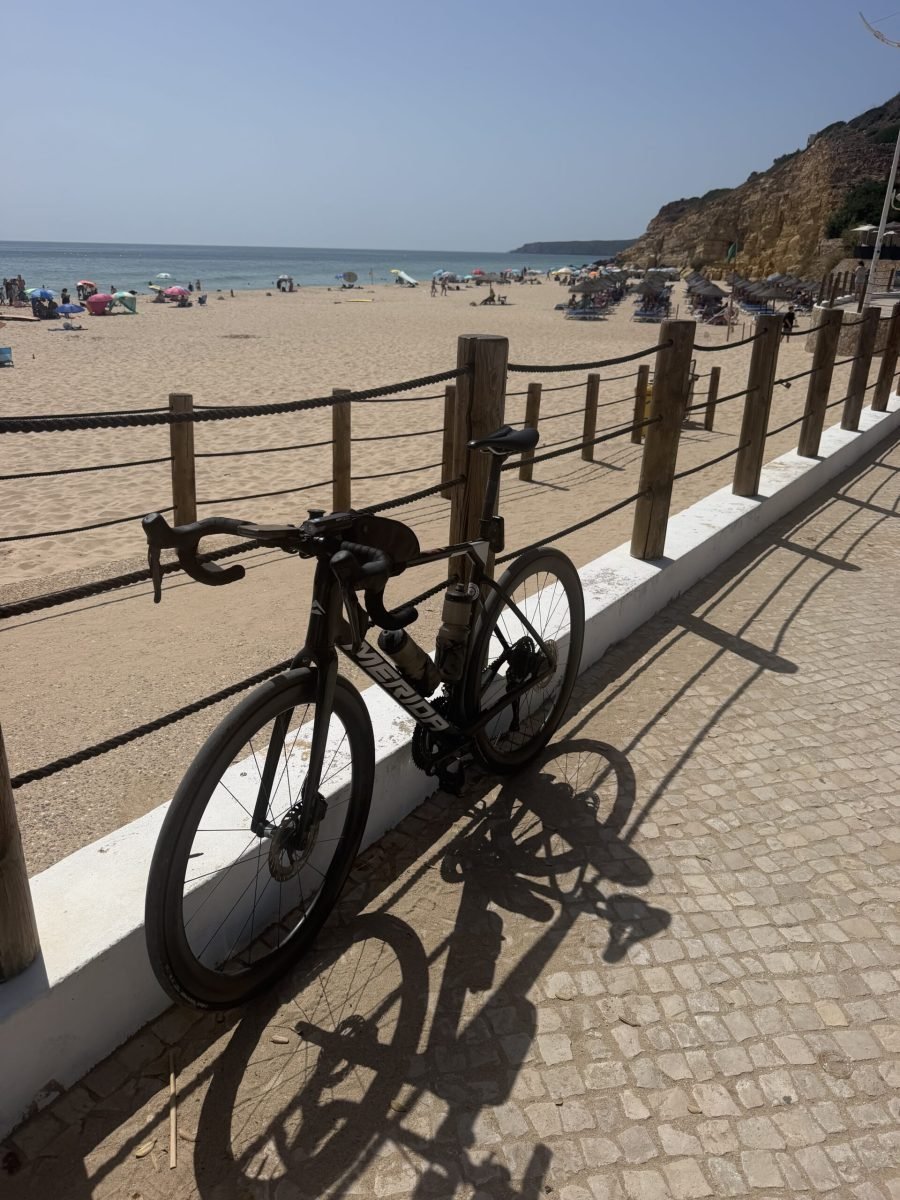
Back through Sagres and Vila do Bispo, the return took the coast road east, and the drop into Salema went right down to the sea. I stopped at Praia de Salema for a breather, bike propped on the rail above the beach, then paid for it straight away. The climbing on this ride came thickest between Vila do Bispo and Burgau: the road out of Salema kicks up hard before dropping to Boca do Rio, then climbs again past the old fort at Almádena, the steepest pull of the day and the hardest effort I put in.
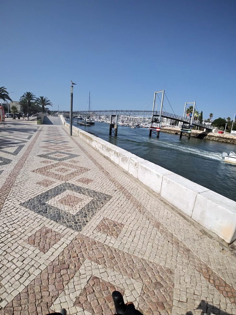
Burgau earned another stop by the sea, then it was on through Luz and over the last rise before dropping into Lagos, with the coast spread out below. Lagos meant a slow roll along the waterfront, all patterned pavement, palm trees and the marina footbridge, and a 25-minute stop before turning inland for home.
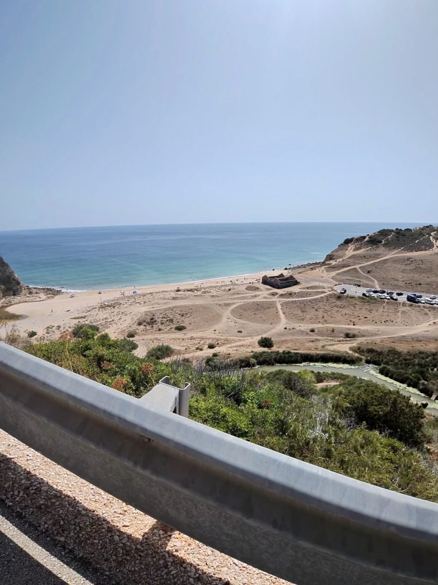
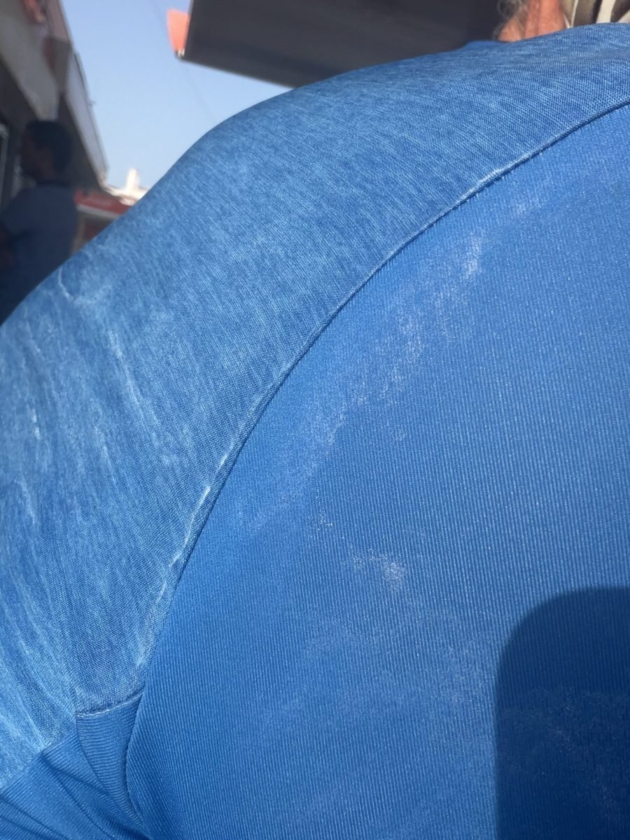
The last 40 km retraced the morning’s roads back through Monte Judeu, over the river at Portimão and up through Estombar to Silves. By the last stop there I’d been out for nearly ten hours, seven of them pedalling, and Garmin reckoned I’d sweated out around 5 litres along the way. You could see where it had gone: white tide-lines of salt all over my jersey and shorts. A cracking way to start the trip.
The numbers
- Ride: #1078 on Strava, ride 207 of 2026, day 87 of the streak
- Distance: 164.7 km
- Moving time: 7:18:33 (10:22:30 elapsed)
- Elevation: 1,758 m
- Average power: 123 W
- Heart rate: 111 bpm average, 150 max
- Cadence: 86 rpm average
- Calories: 3,852 kcal
- Highlight: Subida Forte de Almádena – 0.58 km, 59 m, 3:28 at 249 W
- Conditions: clear and sunny, 22.8°C at the start, 70% humidity, a light northerly breeze
- Year to date: Distance 16,220 km, Elevation Gain 168,749 m
The route
Download the GPX (start and finish trimmed for privacy)
The profile and climbs
18 climbs, all uncategorised. Biggest: 1.1 km at 5.2%, 57 m of climbing (from km 105). Together the climbs account for 601 m of the ride’s ascent.
UncategorisedPins mark where each Garmin ClimbPro climb starts. Hover or tap a pin for details.
Climbs table
| # | Starts at km | Length | Ascent | Avg grade | Time | Avg power | Category |
|---|---|---|---|---|---|---|---|
| 1 | 6.3 | 1.33 km | 47 m | 3.5% | 4:37 | 230 W | Uncategorised |
| 2 | 7.7 | 0.09 km | 2 m | 2.3% | 0:16 | 183 W | Uncategorised |
| 3 | 12.4 | 0.81 km | 30 m | 3.7% | 2:38 | 250 W | Uncategorised |
| 4 | 21.4 | 0.88 km | 33 m | 3.8% | 3:01 | 251 W | Uncategorised |
| 5 | 34.0 | 0.97 km | 38 m | 4% | 3:43 | 217 W | Uncategorised |
| 6 | 38.2 | 1.28 km | 41 m | 3.2% | 4:41 | 189 W | Uncategorised |
| 7 | 57.4 | 0.52 km | 19 m | 3.7% | 2:08 | 188 W | Uncategorised |
| 8 | 62.1 | 0.63 km | 18 m | 2.9% | 2:20 | 191 W | Uncategorised |
| 9 | 94.9 | 1.16 km | 45 m | 3.9% | 4:30 | 194 W | Uncategorised |
| 10 | 97.8 | 0.56 km | 21 m | 3.8% | 2:11 | 202 W | Uncategorised |
| 11 | 100.3 | 0.95 km | 36 m | 3.8% | 3:54 | 191 W | Uncategorised |
| 12 | 103.0 | 1.16 km | 54 m | 4.6% | 5:46 | 191 W | Uncategorised |
| 13 | 105.2 | 1.11 km | 57 m | 5.2% | 5:51 | 212 W | Uncategorised |
| 14 | 113.2 | 0.60 km | 18 m | 3% | 2:22 | 164 W | Uncategorised |
| 15 | 115.6 | 0.79 km | 22 m | 2.8% | 2:49 | 187 W | Uncategorised |
| 16 | 139.1 | 0.72 km | 43 m | 5.9% | 3:18 | 249 W | Uncategorised |
| 17 | 152.0 | 0.76 km | 24 m | 3.2% | 2:51 | 187 W | Uncategorised |
| 18 | 163.2 | 1.43 km | 53 m | 3.7% | 6:31 | 219 W | Uncategorised |