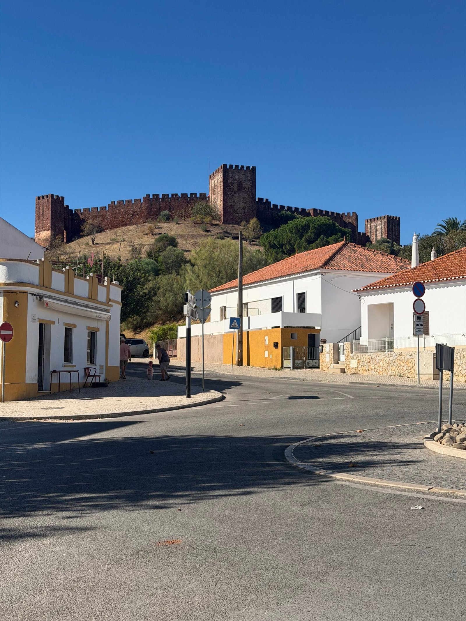
Day five in the Algarve, and on paper a rest day. I’d spent the first few days riding in and out of Silves without ever going up to look at the castle that sits over the town, so I started by putting that right: a few easy kilometres through the streets and then twenty-odd minutes looking around Silves Castle before the day warmed up.
The plan after that was loose: get some hill climbing in while the morning was still fresh, then head for the coast and finish at the beach. It’s an elastic definition of rest, but it’s a holiday, and this was my second so-called rest day of the trip after day three.
From Silves the road heads north into the serra, and it doesn’t take long to start going up. The first proper climb came at 11 km, and from there it was one ramp after another through the cork oaks and dry scrub, with the views opening up over the hills as I gained height. Out past São Marcos da Serra I turned west on the road towards Alferce, where the two longest climbs of the day were waiting.


The hardest of them was the climb past Cansino, over 3 km at nearly 7% with steeper ramps that had me grinding along at a low cadence. Straight after it came the long drag up into Alferce, a village of painted walls and signposts pointing to Monchique and Picota, where I stopped for a breather. Just beyond it the road topped out at a little over 400 m, the high point of the day.
Then the reward: a long, fast descent south off the hills and flatter roads down the valley to Porto de Lagos. I paused there beside a river that the summer had shrunk to a few green pools, then took a longer break a little further on before turning east for Silves.
The way back crossed the Ribeira de Odelouca and followed the valley into Silves, past the river and the old bridge at the foot of the town, and out the other side with a last look back at the white houses climbing the hill.


From there it was south through a short tunnel and on towards Lagoa and the coast. For a holiday area the roads were kind all day: just 297 vehicles passed me in 121 km. By four o’clock I was rolling down to the sea, with big blue letters by the road announcing Praia do Carvoeiro.
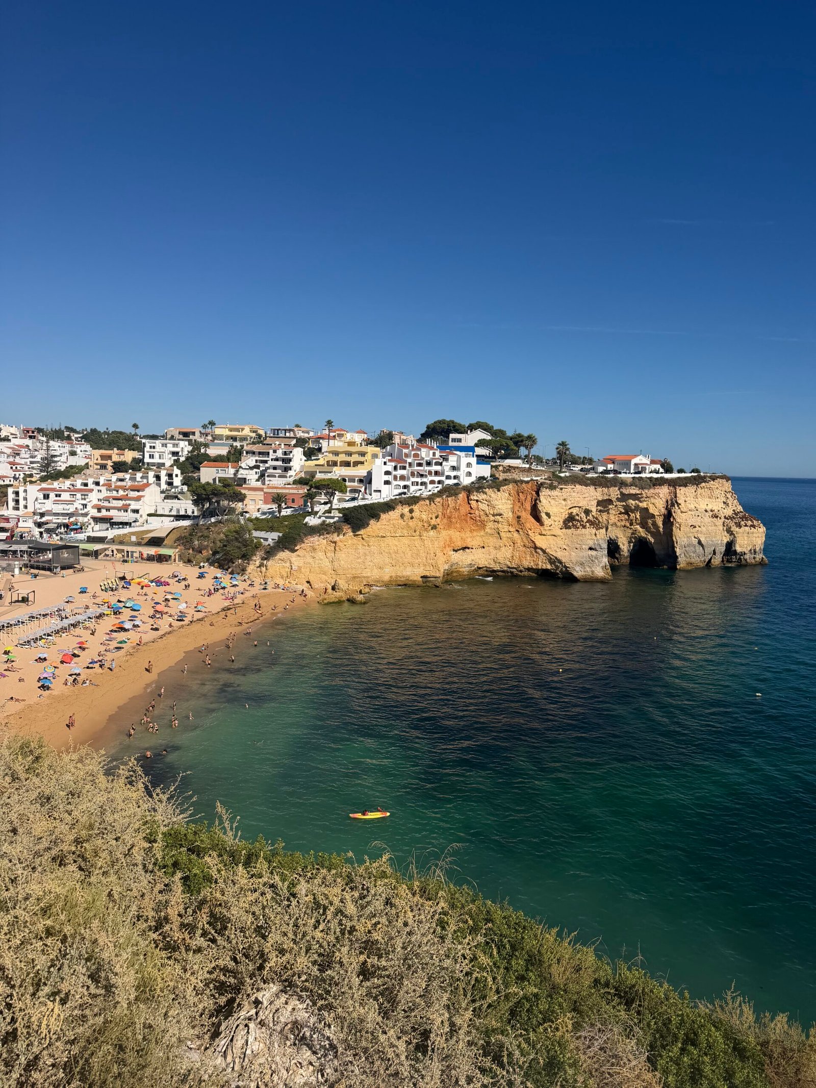
Carvoeiro was everything the postcards promise: a small bay of golden sand tucked between ochre cliffs, and water so clear and turquoise it barely looked real. I spent twenty minutes taking it in, then headed back inland for a short stop in Lagoa and the last 20 km home.


Back at base the tally was 121 km and nearly 1,900 m of climbing, and Garmin reckoned I’d sweated out over 4 litres along the way. A castle, the hills and a beach all in one ride – a strange sort of rest day, but I’m not complaining.
The numbers
- Ride: #1082 on Strava, ride 211 of 2026, day 91 of the streak
- Distance: 121.3 km
- Moving time: 5:52:19 (8:18:25 elapsed)
- Elevation: 1,857 m
- Average power: 130 W
- Heart rate: 106 bpm average, 139 max
- Cadence: 82 rpm average
- Calories: 3,249 kcal
- Highlight: Cansino climb – 3.23 km, 222 m, 18:54 at 191 W
- Conditions: clear and sunny, 19.1°C at the start, 69% humidity, a light northerly breeze
- Year to date: Distance 16,930 km, Elevation Gain 177,164 m
The route
Download the GPX (start and finish trimmed for privacy)
The profile and climbs
20 climbs: 2 Cat 3, 4 Cat 4, 14 uncategorised. Biggest: 4.8 km at 5.6%, 269 m of climbing (Cat 3, from km 46). Together the climbs account for 1,356 m of the ride’s ascent.
Cat 3Cat 4UncategorisedPins mark where each Garmin ClimbPro climb starts. Hover or tap a pin for details.
Climbs table
| # | Starts at km | Length | Ascent | Avg grade | Time | Avg power | Category |
|---|---|---|---|---|---|---|---|
| 1 | 11.1 | 1.88 km | 106 m | 5.6% | 9:46 | 208 W | Cat 4 |
| 2 | 18.8 | 1.33 km | 87 m | 6.5% | 7:05 | 237 W | Cat 4 |
| 3 | 20.8 | 0.56 km | 19 m | 3.3% | 2:03 | 216 W | Uncategorised |
| 4 | 22.1 | 1.77 km | 53 m | 3.0% | 6:01 | 196 W | Uncategorised |
| 5 | 24.3 | 0.51 km | 12 m | 2.3% | 1:30 | 198 W | Uncategorised |
| 6 | 26.2 | 1.31 km | 82 m | 6.3% | 6:14 | 239 W | Cat 4 |
| 7 | 30.8 | 1.62 km | 52 m | 3.2% | 5:41 | 200 W | Uncategorised |
| 8 | 34.3 | 1.75 km | 132 m | 7.5% | 10:37 | 211 W | Cat 4 |
| 9 | 38.6 | 4.85 km | 248 m | 5.1% | 23:43 | 177 W | Cat 3 |
| 10 | 45.9 | 4.82 km | 269 m | 5.6% | 51:24 | 179 W | Cat 3 |
| 11 | 51.2 | 0.51 km | 18 m | 3.6% | 1:38 | 222 W | Uncategorised |
| 12 | 60.2 | 0.64 km | 26 m | 4.0% | 2:33 | 208 W | Uncategorised |
| 13 | 63.6 | 0.85 km | 33 m | 3.9% | 3:17 | 203 W | Uncategorised |
| 14 | 69.2 | 0.78 km | 27 m | 3.5% | 2:27 | 217 W | Uncategorised |
| 15 | 81.0 | 1.16 km | 51 m | 4.4% | 4:20 | 243 W | Uncategorised |
| 16 | 83.0 | 0.60 km | 15 m | 2.5% | 1:56 | 246 W | Uncategorised |
| 17 | 94.0 | 0.61 km | 29 m | 4.7% | 3:20 | 240 W | Uncategorised |
| 18 | 95.7 | 0.54 km | 22 m | 4.2% | 2:22 | 208 W | Uncategorised |
| 19 | 103.3 | 0.91 km | 29 m | 3.2% | 3:11 | 179 W | Uncategorised |
| 20 | 119.7 | 1.55 km | 46 m | 3.0% | 6:05 | 155 W | Uncategorised |