
Day eight of the Algarve trip, and the day I’d saved for Fóia. I rolled out of Silves at half past seven on a clear, still Sunday morning with a plan to go up and over Fóia, the highest point in the Algarve, drop off the far side into the Alentejo, and come home the long way round through Ourique and Castro Verde. It was already 19°C as I set off, with only a faint north-easterly, and the climbing came first.
The opening kilometres were an easy warm-up west along the valley through Porto de Lagos and onto the EN266, the road that would carry me all the way up to the summit. At Rasmalho I paused for the storks: a tall pole by the road carried great untidy nests, with the birds standing on top as if they owned the place. It was the first of the day’s highlights, and one of the sights of southern Portugal I never tire of.
Just past Rasmalho the Garmin flashed up the climb: an HC, 16 km and nearly 790 m to the top. The climb to Fóia goes up past Caldas de Monchique and through Monchique town, then on up the open upper slopes to the summit. I kept it steady at around 235 W and it took me just under an hour and ten minutes.


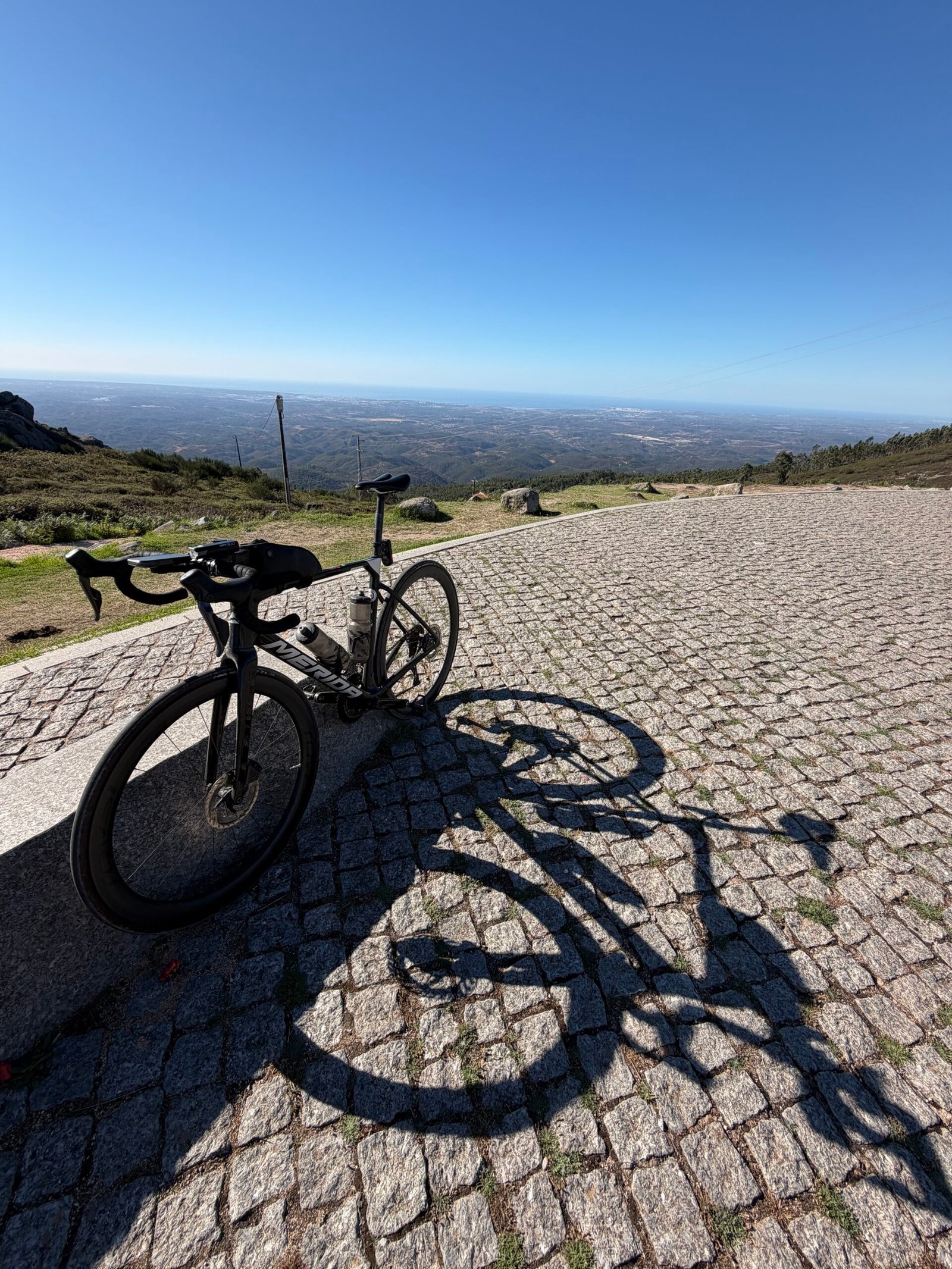
I reached the top just before ten. It was clear, with the plains hazy far below, and I took the best part of three-quarters of an hour over it: a selfie by the summit stone in pink, the colour of the Maglia Rosa, the Giro’s race leader’s jersey (fair enough after the day’s only HC climb), and the bike propped on the cobbles. Then it was down the north side, nearly 30 km of mostly downhill past Nave Redonda and out of the Algarve altogether.
The Alentejo is a different world on a bike: open, rolling country, long straight roads and hardly any traffic, though it was never quite flat: Garmin flagged two Cat 4 climbs between Luzianes and São Martinho das Amoreiras. I stopped in Santa Clara-a-Velha, again at Aldeia das Amoreiras and then at Ourique, keeping the bottles full as the day warmed up. By Ourique I was 120 km in and it was twenty to three. Across the whole ride just 182 vehicles passed me.
Castro Verde was the turning point. I rolled down a street hung with dozens of coloured umbrellas and found Casa Dona Maria, a 20th-century house that is all towers and balconies, before my longest stop since Fóia.
From there it was south on long, straight roads to Almodôvar for one more break, and then the last real climb of the day: 8 km up to Pico do Mu, steady at a little over 3%. Wind turbines lined the ridge ahead on the way up.


At the top, 574 m up, I stopped for a selfie by the sign with the evening sun behind the mast; it was quarter to seven and I still had 45 km to go. From there it was nearly all downhill, and I touched 75 km/h, my fastest of the day, coming off the ridge past Sítio das Éguas, through Marreiros and São Bartolomeu de Messines, then one last sting, a 1.7 km rise just past Messines, before the final lumps back to Silves.
I rolled into Silves just after sunset, more than 13 hours after leaving that morning, and the best part of 10 of them spent pedalling. Garmin reckoned I’d sweated out around 7.5 litres over the day. Storks, Fóia, a street full of umbrellas and a ridge of turbines – a long day, and a good one.
The numbers
- Ride: #1085 on Strava, ride 214 of 2026, day 94 of the streak
- Distance: 224.5 km
- Moving time: 10:10:27 (13:15:28 elapsed)
- Elevation: 3,106 m
- Average power: 143 W
- Heart rate: 115 bpm average, 159 max
- Cadence: 88 rpm average
- Calories: 6,070 kcal
- Highlight (Strava segment): Subida da Fóia (EN266) – 16.28 km, 770 m, 1:09:28 at 235 W
- Conditions: clear and sunny, 19°C at the start, 73% humidity, a light NE breeze
- Year to date: Distance 17,490 km, Elevation Gain 184,862 m
The route
Download the GPX (start and finish trimmed for privacy)
The profile and climbs
17 climbs: 1 HC, 1 Cat 3, 2 Cat 4, 13 uncategorised. Biggest: 16.2 km at 4.8%, 784 m of climbing (HC, from km 27). Together the climbs account for 1,789 m of the ride’s ascent. Garmin and Strava measure climbs and segments over their own start and finish points, so the figures here can differ from the Highlight above and from each other.
HC Cat 3 Cat 4 UncategorisedPins mark where each Garmin ClimbPro climb starts. Hover or tap a pin for details.
Climbs table
| # | Climb | Category | Starts at km | Length | Ascent | Avg grade | Time | Avg speed | Avg power | My rank | My best |
|---|---|---|---|---|---|---|---|---|---|---|---|
| 1 | EN 124, Cerro da Ponte | Uncategorised | 16.4 | 1.01 km | 34 m | 3.4% | 3:22 | 17.9 km/h | 226 W | 2 of 2 | 3:03 |
| 2 | Fóia | HC | 27.0 | 16.16 km | 784 m | 4.8% | 69:16 | 14.0 km/h | 234 W | 1 of 1 | 69:16 |
| 3 | EN 266, Alcaria do Peso | Uncategorised | 52.9 | 1.17 km | 48 m | 4.2% | 4:58 | 14.1 km/h | 204 W | 2 of 2 | 4:45 |
| 4 | ER 266, Santa Clara-a-Velha | Uncategorised | 79.2 | 0.93 km | 33 m | 3.6% | 3:39 | 15.3 km/h | 189 W | 1 of 1 | 3:39 |
| 5 | ER 266, Saboia | Uncategorised | 81.4 | 2.04 km | 56 m | 2.7% | 6:48 | 18.0 km/h | 209 W | 1 of 1 | 6:48 |
| 6 | ER 123, Luzianes-Gare | Cat 4 | 92.4 | 2.69 km | 82 m | 3.1% | 9:38 | 16.8 km/h | 204 W | 1 of 1 | 9:38 |
| 7 | ER 123, São Martinho das Amoreiras | Cat 4 | 98.5 | 2.87 km | 93 m | 3.2% | 11:30 | 15.0 km/h | 174 W | 1 of 1 | 11:30 |
| 8 | CM 1130, São Martinho das Amoreiras | Uncategorised | 106.5 | 1.51 km | 51 m | 3.4% | 5:32 | 16.4 km/h | 203 W | 1 of 1 | 5:32 |
| 9 | CM 1130, Monte do Saraiva | Uncategorised | 110.8 | 0.73 km | 26 m | 3.6% | 2:52 | 15.3 km/h | 224 W | 1 of 1 | 2:52 |
| 10 | CM 1130, Ourique | Uncategorised | 119.5 | 1.99 km | 60 m | 3.0% | 22:49 | 5.2 km/h | 199 W | 1 of 1 | 22:49 |
| 11 | Rua Nova da Feira | Uncategorised | 135.8 | 0.68 km | 24 m | 3.5% | 3:14 | 12.7 km/h | 177 W | 1 of 1 | 3:14 |
| 12 | CM 1198, Fonte Ferrenha de Cima | Cat 3 | 170.1 | 8.28 km | 285 m | 3.4% | 29:08 | 17.0 km/h | 196 W | 1 of 1 | 29:08 |
| 13 | CM 1239, Éguas | Uncategorised | 185.8 | 1.31 km | 45 m | 3.5% | 5:01 | 15.7 km/h | 204 W | 1 of 1 | 5:01 |
| 14 | CM 1239, Éguas | Uncategorised | 189.0 | 0.68 km | 28 m | 4.1% | 2:37 | 15.6 km/h | 220 W | 1 of 1 | 2:37 |
| 15 | near Barradas | Uncategorised | 212.1 | 1.67 km | 79 m | 4.7% | 6:34 | 15.3 km/h | 247 W | 1 of 1 | 6:34 |
| 16 | near Corte | Uncategorised | 216.4 | 0.51 km | 13 m | 2.6% | 1:40 | 18.3 km/h | 162 W | 1 of 1 | 1:40 |
| 17 | – | Uncategorised | 223.0 | 1.46 km | 48 m | 3.3% | 5:17 | 16.6 km/h | 215 W | 4 of 4 | 4:55 |
My rank places this ride among my outdoor rides over the same climb on Garmin up to that day, matched by GPS, and My best is the fastest of them at the time. Time and speed include any stop on the climb.
Related
Related rides
- Forty-Three Climbs: the 263 km day with 43 climbs, also over Monchique
- Nine Days in the Algarve: the totals for all nine rides
Every town, café, beach and landmark from my rides is collected on the Links page.